| Version 41 (modified by benj, 14 years ago) (diff) |
|---|
Procedures
These pages document established procedures for processing, data delivery, archiving, etc. Please be aware that these pages may be written in technical language as they are mainly used for documenting internal processing.
Project processing procedure
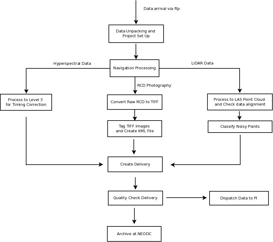
This page contains links to detailed step-by-step instructions on how to deal with data from arrival to dispatch to the user. Please keep updated. A simplified overview of the procedures can be seen in the flow chart. Clicking on the relevant section will give a more detailed, technical description.

The following sections are mainly of interest to ARSF - DAN operatives.
Other procedures
- How to update azgcorr and who to notify
- What needs to be done prior to starting a new season
- User support?
- (2010 and earlier) r-syncing from the workspace to the repository
- Creation of Eagle and Hawk calibration files from raw calibration data
Guides to using non-standard software and obsolete software processing methodology
- Processing with CaliGeo
- Atmospheric correction using ATCOR
- Handling bad ATM scanlines with az software
- Creation of DEMs from Optech LIDAR point clouds (pre-2009 data)
- Tips on using Microstation and TerraScan
- Match 2 images by boresight corrections
- How to generate overflow and low signal masks for specim sensors
Information on data in system
- Filenaming conventions and structure of unpacked data
- Status of requested OS vectors
- List of all ARSF Scripts Please keep updated
- Information on the boresights
- Information on the leverarms
Attachments (1)
-
simple_overview.jpeg
(47.1 KB) -
added by mark1 14 years ago.
Simple overview of the procedural chain
Download all attachments as: .zip