| Version 1 (modified by mggr, 19 years ago) (diff) |
|---|
Boresight calibration
2007 point locations and notes
| Point | ETRS 89 (WGS 84) | Pos Qlty | Hgt Qlty | Pos+Hgt Qlty | OS Grid (OSGB 36) | ||||
| Id. | X | Y | Z | Quality | Quality | Quality | E | N | H |
| 1 | 3899990.9122 | -16767.0766 | 5030016.9027 | 0.0096 | 0.0146 | 0.0175 | 519414.561 | 279216.784 | 44.499 |
| 2 | 3899983.7474 | -16573.9922 | 5030023.1466 | 0.0049 | 0.0063 | 0.0080 | 519607.267 | 279231.601 | 44.576 |
| 3 | 3899977.7336 | -16320.1818 | 5030025.6952 | 0.0120 | 0.0178 | 0.0214 | 519860.745 | 279244.932 | 42.279 |
| 4 | 3899843.8284 | -16318.7154 | 5030129.9893 | 0.0035 | 0.0069 | 0.0077 | 519857.522 | 279414.596 | 43.201 |
| 5 | 3899738.4140 | -16316.4996 | 5030210.5789 | 0.0017 | 0.0020 | 0.0027 | 519856.068 | 279547.267 | 42.728 |
| 6 | 3899731.4446 | -16091.6668 | 5030214.0582 | 0.0002 | 0.0005 | 0.0006 | 520080.550 | 279561.121 | 40.668 |
| 7 | 3899489.7218 | -16085.1161 | 5030392.4048 | 0.0040 | 0.0062 | 0.0074 | 520078.781 | 279861.452 | 34.480 |
Please note: point 25 on the previous survey is the same point as point 7 on this survey. As point 7 is an average solution derived from four other points + a temporary base station the result above is a far better solution..
Attachments (5)
-
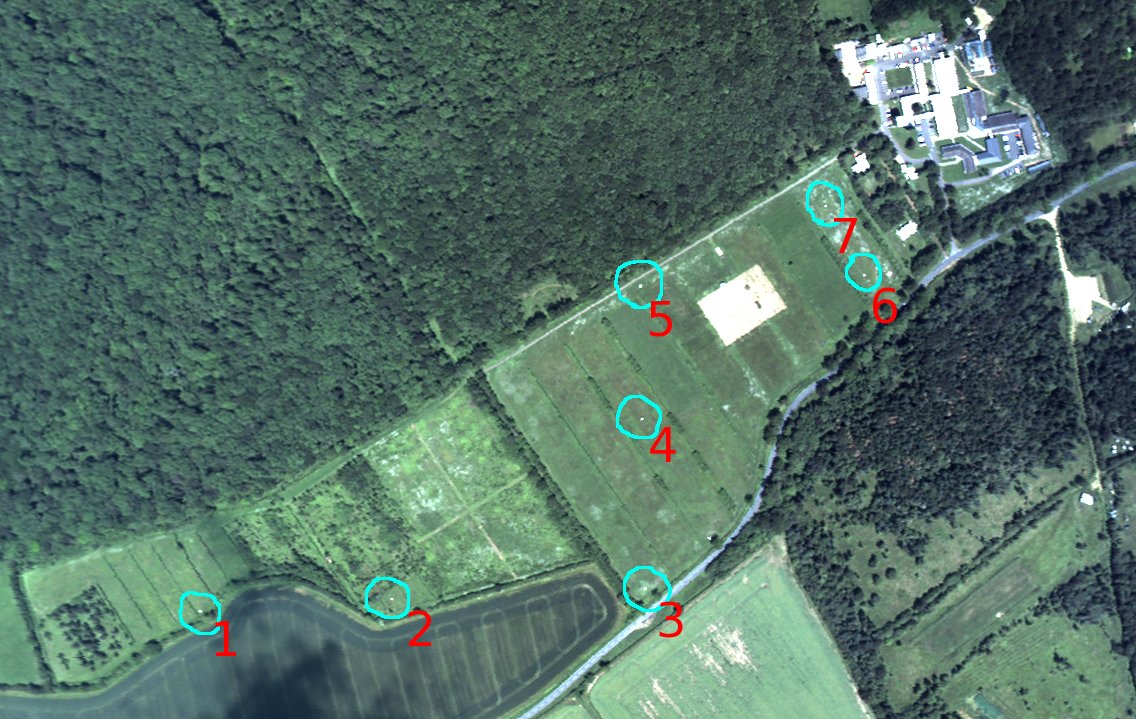
MWtargets.jpg
(66.8 KB) -
added by mggr 19 years ago.
Monkswood calibration targets
-
MWtargets-annotated.jpg
(208.1 KB) -
added by mggr 19 years ago.
Monkswood calibration targets (annotated)
-
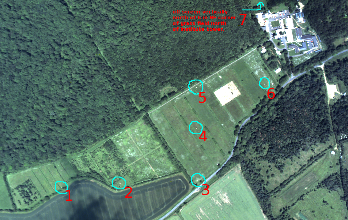
MWtargets-annotated3.png
(1.7 MB) -
added by mggr 17 years ago.
Monkswood calibration targets (annotated)
-
calib_points.evf
(976 bytes) -
added by mggr 17 years ago.
ENVI vector file holding Monks Wood calibration points (BNG coordinate system)
-
coords1.xls
(14.5 KB) -
added by mggr 17 years ago.
Andrew Wilson's original Excel spreadsheet holding Monks Wood calibration points (BNG coordinate system)
Download all attachments as: .zip