| Version 3 (modified by mggr, 19 years ago) (diff) |
|---|
Boresight calibration
Copy of email to Andrew Wilson (wikise later)
As I understand it, a calibration flight passes over CEH several times in opposing directions.

The idea is to process the data sets and overlay them, then adjust the PRH numbers until things line up exactly over the calibration points (and hopefully everywhere else).

Because the flights are in opposing directions, one can "focus" the points inwards towards convergence by using estimates of distance and direction of flight/direction to convergence.

Additionally, you have the positions of the calibration points exactly measured (by placing a GPS unit on them for several hours at different times of day) and also have a base station in the flight line (in the CEH tower?).  Once the calibration is correct, the mapped position of these points should match your recorded coordinates (if this is correct, how accurate do you normally get this?).

Obviously, this would need to be done for each sensor (ATM, CASI, Hawk & Eagle).  The LIDAR correction is handled by Cambridge?

Also, which tools do you normally use?  I'm presuming you mostly use Imagine with the GeoTIFFs?
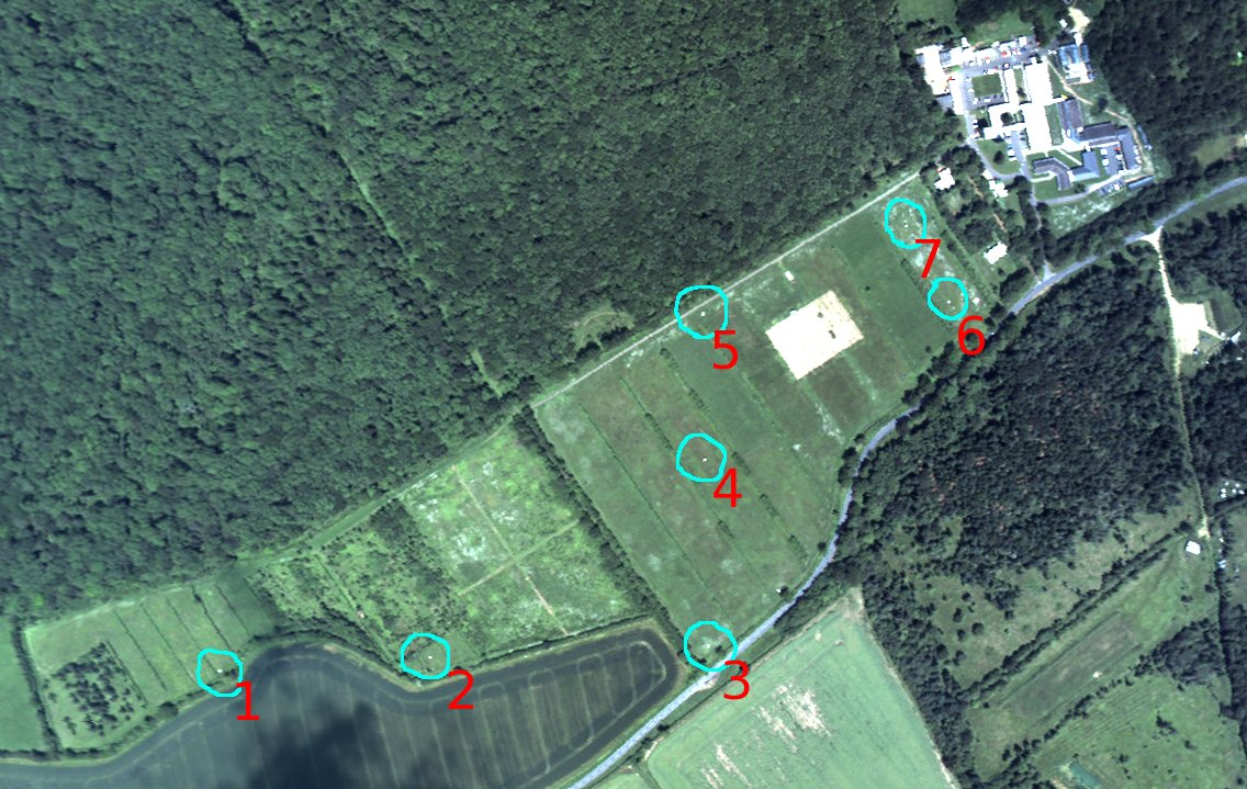
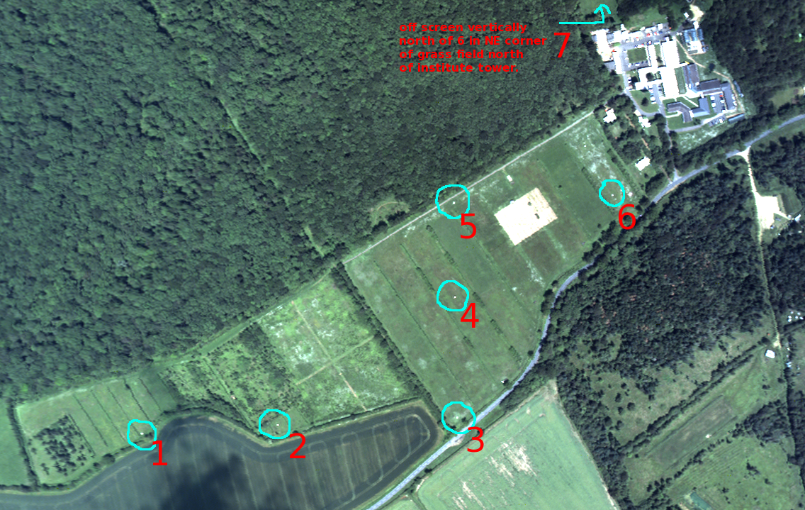
2007 point locations and notes
| Point | ETRS 89 (WGS 84) | Pos Qlty | Hgt Qlty | Pos+Hgt Qlty | OS Grid (OSGB 36) | ||||
| Id. | X | Y | Z | Quality | Quality | Quality | E | N | H |
| 1 | 3899990.9122 | -16767.0766 | 5030016.9027 | 0.0096 | 0.0146 | 0.0175 | 519414.561 | 279216.784 | 44.499 |
| 2 | 3899983.7474 | -16573.9922 | 5030023.1466 | 0.0049 | 0.0063 | 0.0080 | 519607.267 | 279231.601 | 44.576 |
| 3 | 3899977.7336 | -16320.1818 | 5030025.6952 | 0.0120 | 0.0178 | 0.0214 | 519860.745 | 279244.932 | 42.279 |
| 4 | 3899843.8284 | -16318.7154 | 5030129.9893 | 0.0035 | 0.0069 | 0.0077 | 519857.522 | 279414.596 | 43.201 |
| 5 | 3899738.4140 | -16316.4996 | 5030210.5789 | 0.0017 | 0.0020 | 0.0027 | 519856.068 | 279547.267 | 42.728 |
| 6 | 3899731.4446 | -16091.6668 | 5030214.0582 | 0.0002 | 0.0005 | 0.0006 | 520080.550 | 279561.121 | 40.668 |
| 7 | 3899489.7218 | -16085.1161 | 5030392.4048 | 0.0040 | 0.0062 | 0.0074 | 520078.781 | 279861.452 | 34.480 |
Please note: point 25 on the previous survey is the same point as point 7 on this survey. As point 7 is an average solution derived from four other points + a temporary base station the result above is a far better solution..
")
Attachments (5)
-
MWtargets.jpg
(66.8 KB) -
added by mggr 19 years ago.
Monkswood calibration targets
-
MWtargets-annotated.jpg
(208.1 KB) -
added by mggr 19 years ago.
Monkswood calibration targets (annotated)
-
MWtargets-annotated3.png
(1.7 MB) -
added by mggr 17 years ago.
Monkswood calibration targets (annotated)
-
calib_points.evf
(976 bytes) -
added by mggr 17 years ago.
ENVI vector file holding Monks Wood calibration points (BNG coordinate system)
-
coords1.xls
(14.5 KB) -
added by mggr 17 years ago.
Andrew Wilson's original Excel spreadsheet holding Monks Wood calibration points (BNG coordinate system)
Download all attachments as: .zip