Opened 18 years ago
Closed 18 years ago
#90 closed task (fixed)
Experiment with and compare processed LIDAR to NextMAP
| Reported by: | mggr | Owned by: | benj |
|---|---|---|---|
| Priority: | alpha 4 high | Milestone: | The Glorious Future |
| Component: | Processing: LIDAR | Keywords: | |
| Cc: | Other processors: |
Description
Have a look at the LIDAR point cloud available in ~arsf/arsf_data/in_progress/2007/flight_data/uk/GB2007_06-2007_192a_Dorchester (lidar/07*).
Attempt to process it into a DEM and any necessary cleanup using GRASS (Environment Agency use GRASS too). Ask me to talk you through the data format (it has some weirdities) before you start.
Compare against the existing NextMAP DEM (tiles sy69,sy78,sy79) to see how 'good' the result is.
Document GRASS procedure on the wiki! (maybe http://www.npm.ac.uk/rsg/projects/arsf/trac/wiki/Processing/LIDARDEMs)
Attachments (1)
Change History (2)
Changed 18 years ago by benj
comment:1 Changed 18 years ago by benj
- Resolution set to fixed
- Status changed from new to closed
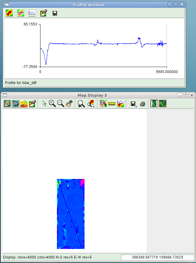
Successfully created a DEM from the Dorchester lidar set and documented process on the wiki (including a couple of relevant scripts).
Difference map/profile between Nextmap DEM and DEM generated from LIDAR dataset:

Difference map between Nextmap and Lidar DEMs