| Version 8 (modified by mark1, 14 years ago) (diff) |
|---|
Calibration Sites

Little Rissington
Active: 2008 onwards
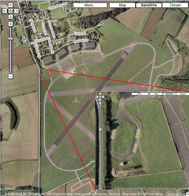
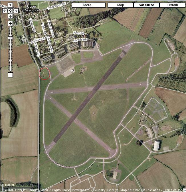
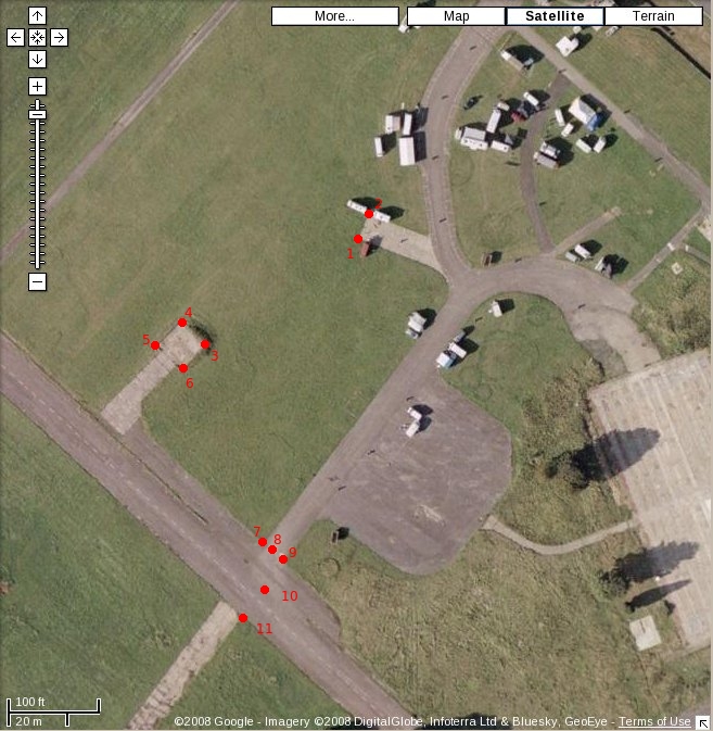
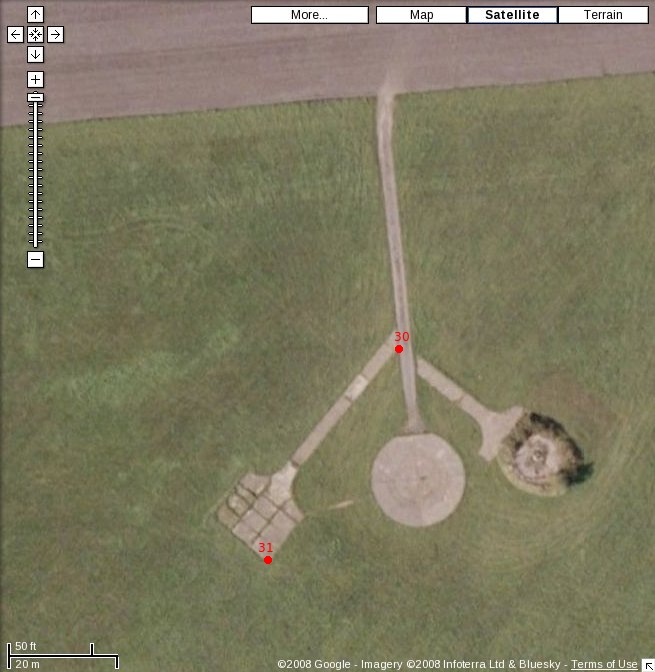
The survey site is at Little Rissington – an old MoD airfield and business park. For the survey, a GPS base station was set up in the grounds of the business park, specifically it was located south west of the first hangar when you enter the business park. The hangar is in use as the premises of a removal firm. This base station site is marked as B on Figure 1. It was collecting data for approximately 9 hours. Whilst the base station was in position collecting data, 64 additional points were surveyed; 63 of which were on the airfield and 1 on the business park. Each point was surveyed using GPS for 5 minutes. The points were surveyed for use as LIDAR, hyperspectral and camera control points, although not all points are suitable for every sensor. Photographs were taken of all the survey points by both Sterling Surveys and ARSF
See the attached documents for details.
The attached little_riss_survey_Sep08.csv file contains the locations of ground control points surveyed at the site.
Note: Point 64 shown on the image is in the business park to the north of the airfield (top left corner of image).
Attachments (18)
-
littleriss_survey.odt
(1.2 MB) -
added by mark1 17 years ago.
Ground survey report including point locations
-
little_riss_survey_Sep08_UTM30_ETRS89.txt
(824 bytes) -
added by mark1 17 years ago.
GCPs for LIDAR processing in UTM30 ETRS89
-
little_riss_survey_Sep08_lidarpoints.txt
(780 bytes) -
added by mark1 17 years ago.
GCPs for LIDAR processing in BNG Newlyn
-
little_riss_survey_Sep08.csv
(2.2 KB) -
added by mggr 17 years ago.
CSV file containing Little Rissington GCP locations in BNG/Newlyn
-
baselocation2.jpg
(101.3 KB) -
added by mggr 17 years ago.
Overview of site with closeup of base station location
-
baselocation_full.jpg
(98.2 KB) -
added by mggr 17 years ago.
Overview of site
-
p1_11.jpg
(245.3 KB) -
added by mggr 17 years ago.
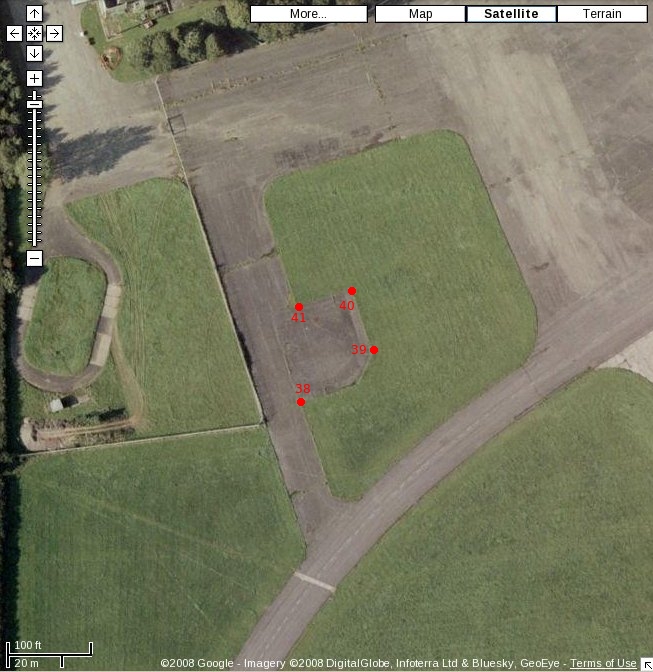
Visual location of GCPs 1-11
-
p12_13.jpg
(241.8 KB) -
added by mggr 17 years ago.
Visual location of GCPs 12-13
-
p30_31.jpg
(185.8 KB) -
added by mggr 17 years ago.
Visual location of GCPs 30-31
-
p38_41.jpg
(230.8 KB) -
added by mggr 17 years ago.
Visual location of GCPs 38-41
-
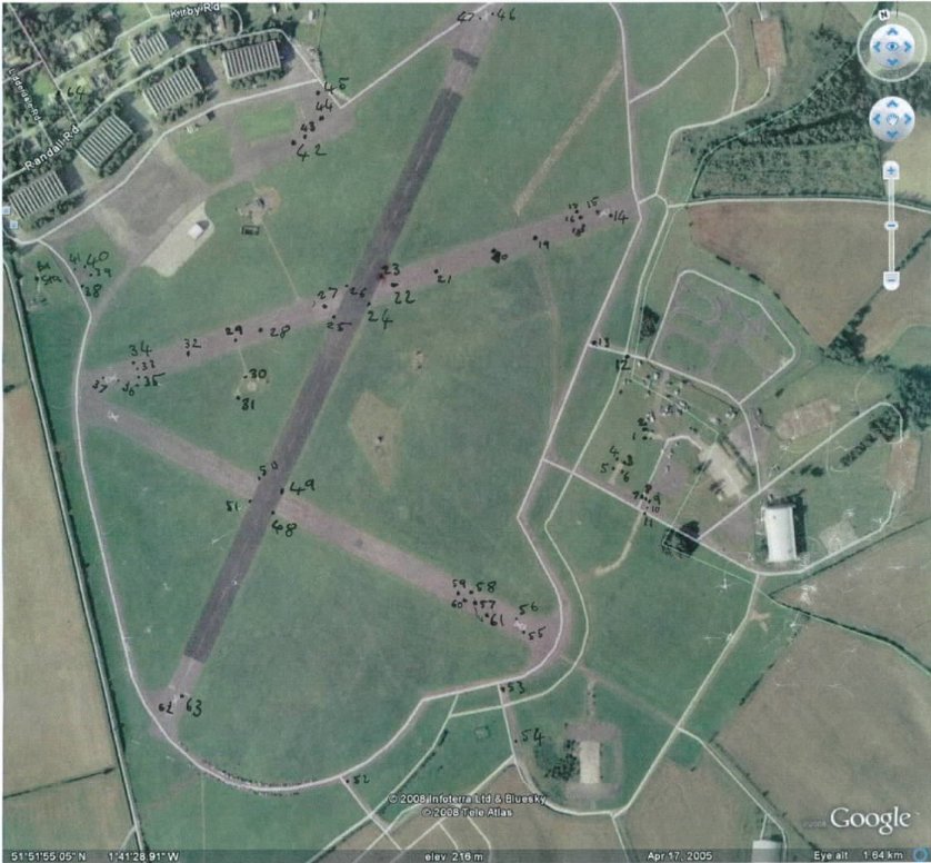
survey.jpg
(116.6 KB) -
added by mggr 17 years ago.
Annotated overview showing approximate locations of GCPs
-
littleriss_survey.pdf
(698.9 KB) -
added by mggr 16 years ago.
Ground survey report including point locations (PDF)
-
monks_wood_coords.csv
(778 bytes) -
added by mark1 14 years ago.
GCPs for monks wood site
-
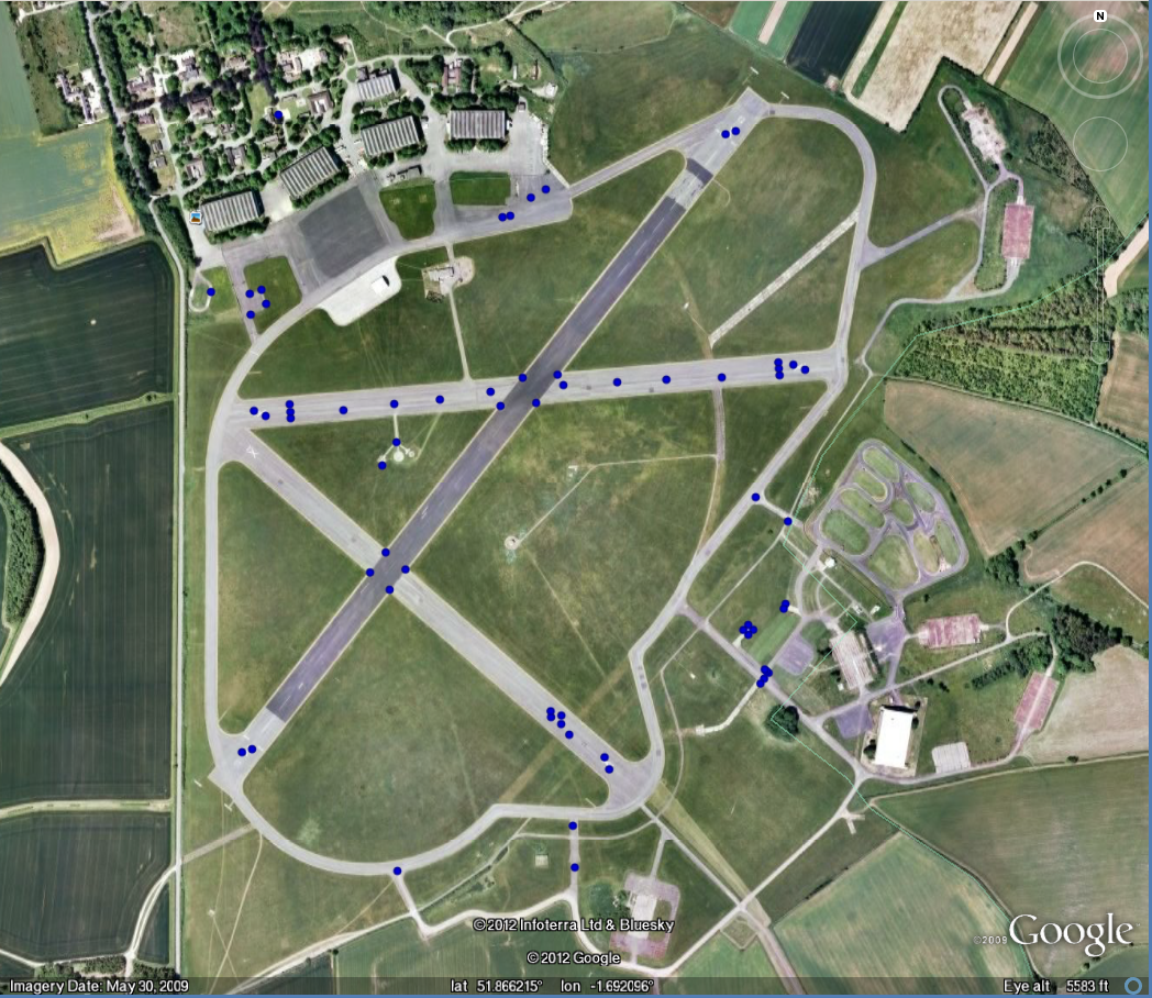
little_riss_points.png
(1.6 MB) -
added by mark1 14 years ago.
google earth image with points overlaid
-
little_riss_survey-wgs84_Sep08.xls
(21.0 KB) -
added by mggr 14 years ago.
Excel file containing Little Rissington GCP locations in WGS84
- alconbury_survey_july2016_osgb36.csv (2.6 KB) - added by dac 9 years ago.
- alconbury_survey_july2016_wgs84.csv (3.6 KB) - added by dac 9 years ago.
- alconbury_survey_points.png (934.9 KB) - added by dac 9 years ago.