Latest status for operational data collection
| Project collection status | Processing status |
Please contact Dr Gary Llewellyn (Science / operations coordinator) if you have any questions or concerns: gaew@… (01452 859945 or 07919 697851)
2017
21.06.17
Today’s long flight concluded the series of surveys over the Alto Tajo region of Spain, just to the east of Madrid. This three day sequence of work was in support of a NERC NC funded project that attained our highest peer review grade (a grade 10; only the second that our panel have awarded). It seeks to investigate the succession and densification following the abandonment of traditional forest management in those woodlands present in Mediterranean mountains. We conducted aerial surveys of this area in 2006 and 2011 so this will be a particularly useful data set. Tomorrow (22.06.17) we plan to transit back to the UK and after a brief consolidation of data we will resume our programme of surveys in the UK.
18.06.17
The sequence of flights conducted on Friday (16.06.17) to investigate land surface temperature (LST) started in the morning and ended in the evening. Conditions were hot both for people and instruments but both the flight crew and field team reconvened at the same hotel in Albacete. Despite the heat, the Specim Owl and Fenix and the digital camera worked well. The following day (Saturday, 17.06.17) we flew a survey just to the west of Valencia to collect data for the validation of the operational and user-generated vegetation products derived from the optical instruments on-board ESA’s Sentinel-2 and -3. This was to support another project in this area (and supported work by a research team led by Jadu Dash). Most of the instruments performed well by we had suspicions concerning some of the LiDAR data returns. After the survey, the flight team relocated to Madrid from where, on the following day, we transferred selected flight lines to our data processing team in the UK to check. Sunday (18.06.17) was a crew rest day.
The first of the Alto Tajo sites to the east of Madrid was flow today (18.06.17). This was in support of one of two remaining projects in this campaign, both with sites in this area. We had concerns with regard to the LiDAR instrument so a study area where other data were important was selected (rather than a site that was completely LiDAR focused). During today’s flight the LiDAR was not able to collect data. However, pre-season modifications to the on-board systems allowed (and will allow) the flying of other instruments in the remote sensing suite despite this. Later discussions with the manufacturer indicate that the LiDAR will not be available for the rest of the campaign. Nevertheless, useful data can still be collected to support one of the projects and we anticipate doing so for the next two days.
16.06.17
Today is the last day of the NERC ATSC summer school in Barrax, Spain. During yesterday’s flight (15.06.17) we supported 22 scientists on the ground with a series of flights over nearby Las Tiesas farm site in Barrax, Spain, using VNIR, SWIR & LWIR instruments (and a 100mp digital camera). This was part of an NERC ATSC summer school and although very hot both the field and airborne surveys were a success. Today we are conducting three flights separated through-out the day to investigate land surface temperature (LST). The key airborne instrument in our suite for this is our LWIR imaging spectrometer (Specim Owl). This group (separate from the summer school and led by Martin Wooster) seek to develop methods for deriving LST/surface spectral emissivity algorithms for retrieving LST and SSE simultaneously and has the potential to validate satellite-based retrieval of LST and SSE.
Tomorrow (17.06.17) we plan to fly over a study site near Valencia to collect data for the validation of the operational and user-generated vegetation products derived from the optical instruments on-board ESA’s Sentinel-2 and -3. This is to support another project in this area (and supports work by a research team led by Jadu Dash).
2015
Sit Rep 29.09.15
On Sunday (27.09.15) we commenced support of HYMOSENS2. This EUFAR funded project is focused on the collection (and analysis) of hyperspectral data from rivers in the Ain / Rhȏne-Alps region (Eastern France). With much consultation with the research team in the field, after several delays due to French air traffic control, instrument problems and persistent cloud over the site (which led to one aborted survey) a two and a half hour survey was flown. However, only part of the area was covered (16 of 30 lines), the river water levels were unusually high and the later part of the survey was outside the desired two hours after solar noon. This later issue was relevant as the project required high quality spectral data and the flying altitude was very low which reduces the strength of the signal from the imaging spectrometers. Nevertheless, discussions with the research team identified a solution which was enacted a couple of days later (on the 29.05.15).
On Monday good conditions in the Alps allowed support of ISOTHERM. This three and a half hour survey sought to collect data from several sites in the Alps surrounding Mont Blanc. The first site, Mer de Glace, was very turbulent but eventually all nine flight lines were collected. The flight crew discussed their concerns but evaluated the conditions to be borderline but definitely safe but collected the last line later in the flight, after the level of turbulence had lessened. The next site (Aiguilles Rouge was covered in cloud but were able to collect twelve lines of data from a third site (Argentiere) before cloud needing to refuel. Another five lines were collected after refuelling but by then cloud was beginning to claim the cover the sky and this survey was concluded after two hours. LiDAR, Fenix and digital photography were collected. Today (29.05.15) we were able to return to allowed the HYMOSENS2 site and collected twenty three lines (including two repeats and a cross line) of LiDAR, Fenix (VNIR & SWIR), Owl (LWIR – not covered in the EUFAR agreement) and digital photography in two and a half hours of flying all within two hours of solar noon. These data were collected at just over 2300ft so a high illumination was essential to preserve the already low signal available from the altitude. Tomorrow we plan to relocate to Toulouse but will check the Alps on route with a view of collecting more data from that area if conditions allow.
Sit Rep 26.09.15
On Wednesday (23.09.15) we transited to Palma in preparation of supporting Med2hyCon, a EUFAR2 funded project in Mallorca. We arrived in Mallorca before the airport became busy over the weekend to improve our chances of access to the air space for aerial surveying. Unfortunately cloud cover prevented data collection on the 24.09.15 and had been present on preceding days. However, these conditions improved on Friday (25.09.15) and we were able to conduct a three and a half hour survey at two altitudes in a part of the island away from the main airport traffic under good conditions. These data included 27 flight lines of Fenix (VNIR & SWIR) data, LiDAR data & digital photography. These data will be used to investigate sediment movement, debris stability and vegetation health in this river catchment.
Our pilots tried to obtain permission from local air traffic control for access to some requested study areas close to the main arrival and departure tracks into Palma airport and had another attempt this morning (Saturday, 26.09.15). However, because the Mallorca airspace that serves Palma airport is very busy (handling more than 700 aircraft a day), permission to fly within the restricted areas has not been granted. Therefore we have re-deployed to Lyon in anticipation of supporting HYMOSENS2 tomorrow (Sunday, 27.09.15) and ISOTHERM the day after (Monday, 28.09.15) should the forecasted weather remain favourable. If conditions do not prove to be suitable we are poised to remain in Lyon for a few days to take advantage of any opportunities that should present themselves. However, once our work in the Lyon area (HYMOSEN2) are and the Swiss Alps (ISOTHERM) is complete we will proceed to Toulouse for support of the final project in this EUFAR2 campaign (AHSPECT).
Sit Rep 07.05.15
Following the replacement of the nose-wheel tires solved the problem and we were able to collect data from the EUFAR Holuhraun site late on the 4th of September. Cloud prevented completion of this project. However, on the following day (05.09.15) we returned and collected VNIR, SWIR and LWIR hyperspectral data (Fenix and Owl), LiDAR and digital photography. This completed this project. On the return flight we were able to collect LiDAR data on from three of the remaining four flight lines from the Hekla site.
The weather prospects for the following days (06.09.15) were very poor and we laid plans to depart to the UK but conscious of the changeable nature of the Icelandic weather we were able to delay and when conditions contrary to the forecast emerged at the study site were able to fully support both areas of interest with all instruments. Consequently data were collected in support of all the projects and the team (and aircraft) returned to Cambridge today (07.09.15). The return flight was approximately 6 hours and 30 minutes with a fuel stop at Prestwick part way.
Sit rep 04.09.15
On the Sunday (30.08.15) we were able to conduct a 2 hour survey over Hekla but the conditions were not good and the following day (31.08.15) the weather conditions did not allow any data to be collected. However, on Tuesday the 1st of September conditions improved. We conducted a 5 and a half hour survey over Hekla from early morning until early afternoon. Despite the Owl’s thermal calibration failing and heavy rain in parts the survey over this site is now substantively complete. The LiDAR coverage is good and we will endeavor to complete the last four lines if the weather and time allow. Flight data possibilities have been discussed fully with the PI and survey objectives have been matched to available weather opportunities.
In the afternoon we were able to collect VNIR & SWIR hyperspectral data (Fenix), LiDAR and digital photography from Holuhraun. This EUFAR funded project is located at a cooling lava flow. The surface is dark and the illumination was low. Consequently the signal-to noise ratio for the hyperspectral systems was also low. Nevertheless, during the 3 and a half hour survey approximately two third of this site were surveyed before incoming clouds forced us to return to Reykjavik Airport.
Unfortunately a problem with the aircraft became evident during take-off and landings. Minor investigations were made between the flights but these did not solve the problem which was judged potentially serious enough to require an engineer to attend to replace the nose-wheel tires. These were ordered from the UK, arrived yesterday (03.09.15) and should be fitted this morning. If this solves the problem we hope to return to Holuraun this afternoon (04.09.15). Nevertheless, the break in operations has been matched with bad weather over all our study sites but did allow us to property download and back-up data and allowed the Hekla field team to view the aircraft and instruments yesterday afternoon.
Sit rep 29.08.15
After a series of delays, partially due to poor weather in Iceland, the aircraft deployed to Reykjavik on Thursday the 27th of August. This was to support an EAA Rannis grant for airborne data from Hekla and two EUFAR funded projects. Immediately prior to departure a BBSRC grant (to study ash die back) was supported but two other grant funded projects were not supported due to persistent bad weather in the UK but we hope to do so once we return from Iceland. Yesterday (28.08.15) we able to conduct our in-county preparations and today (29.08.15) we managed two surveys over Hekla with a combined flight time of almost 7 hours during which we completed approximately half the project (28 of 54 flight lines) including the challenging top of Hekla than is normally covered in cloud. LiDAR, digital photography, Fenix (VNIR and SWIR) data were collected as well as selected areas of Owl (LWIR).
Tomorrow, conditions are forecast to be even better. We hope to collect data from Hekla and from Siglufjordur and Moafellshyma, to the North West of Iceland. The aircraft and instruments are performing well and the three person crew remain well but very busy. The scenery remains stunning and the Icelandic people very friendly.
2014
Sit Rep 02.11.14
Today (02.11.14) we once again deployed for a dawn take-off but our eyes-on-the-ground at Danum Valley (Abdulla), was able to inform us of heavy cloud cloud. This was of course only evident in daylight. However, condition were steadily improving and his observations from the previous day in Danum Valley indicated that condition may clear later in the day. We took-off at 10:00 hrs and were able to collect ten flight lines of very good data from the key area around the research centre in the period around solar noon. This survey supported MA14-11 with the key area also supporting RG13-06 (the BALI NERC grant funded project). Tomorrow (03.11.14) we hope to deploy at 07:00 hrs to make full use of this potential opportunity of relatively cloud free conditions to complete the survey of this site.
Sit Rep 30.10.14
Today (30.10.14) we were able to fly 42 flight lines over the Maliau Basin. Take-off was once again just after dawn and allowed us to complete the data collection (LiDAR, Fenix and Owl) for this site before the build-up of cloud covered the study area. Completion of this area is a huge relief as we have been aware that is was the most prone area to persistent cloud and it forms a significant study area for the NERC Biodiversity and Land-Use Impacts on Tropical Ecosystem Function (BALI) project. Our dedicated representative on the ground (Abdulla) is now able to return to Danum Valley (also in Sabah) where we intend to collect the next set of airborne data.
Sit Rep 25.10.14
Today (25.10.14) our five hour flight started with another dawn take-off from Kota Kinabalu. It is with great relief that I can report that it yielded a three hour survey, with LiDAR, Fenix and digital photography, that concluded our data collection from the SAFE a site (in support of the NERC BALI project). We collected data at three different altitudes, ~3000ft, 7000ft and 9000ft, and were able to make full use of the experience that we have gained from flying this site in terms of the relative speed of cloud build up over the different areas . Tomorrow, the crew will take a well needed rest while our stalwart colleague (Abdulla), who has been manning the gps and sun photometer in the field, relocates to the Malaiu Basin (also in support of the NERC BALI project). This will be our focus of operations on Monday.
Sit Rep 18.10.14
Yesterday (17.10.14) we continued our strategy of early morning data acquisitions from the SAFE site (in support of BALI, the core NERC grant). With engine start at 07:00 (local) within a 4 hour flight we had 3 hours of data collection on site. During this time we completed the last 5 five of 25 long altitude lines that formed an overview of the SAFE site and three of various mid altitude areas within the SAFE site. These data comprised of LiDAR, Fenix (VNIR & SWIR), Owl (LWIR - for some lines) and digital photography. Last night we were rewarded with a particularly spectacular sunset.
Today (18.10.14) we took off 15 minutes earlier and managed 2 hours on site before the cloud closed in. In this case one of the team was suffering from an ear infection so the sortie was achieved with a reduced complement of crew. This made operating in this dynamic environment even more challenging. Nevertheless, we completed two more of the mid altitude areas and two areas at a higher altitude relating to the hydrological component of the project. These data comprised of LiDAR, Fenix (VNIR & SWIR) and digital photography.
Currently we are investigating if the cloud cover is absent at night. If so then this would allow us to consider the collection of one pass of LiDAR data at night for those projects where two passes are planned (double passes are planned as a means to increase the LiDAR point density). If successful it would still leave one pass in daytime conditions to collect coincident data from the imaging spectometers.
ARSF Flights 19.06.14
Over the last few weeks we have had an intensive period of flying to take advantage of the encouraging weather conditions. Our support of the Wessex BESS project (RG12-09) continues and following a month of standby and aborted flights on weekends (in periods when the ranges are cold). We hope to complete the spring/summer component of this project in forecasted good weather this Saturday (21.06.14). This month much of our activity has been focused around the support of GB13-01, a grade 9 project mapping ecosystem services on agricultural land in Suffolk. The four sorties that we have had in support of this project have been limited by a build up of Cumulous late each morning. However, during this period we have also managed to collect to support a project in water meadows near Wytham Woods in Oxfordshire (GB13-10) with an early June acquisition and full waveform data from Merthyr Tydfil (BGS12-01).
Earlier this week a potential problem with the LiDAR was flagged. This relates to a possible fault in the Automatic Gain Control card. A repair will be implemented by an engineer from the instrument manufacturer on Monday (23.06.14). Our data analysis team are investigating the implication of this fault on data collected earlier in the month.
We have a concentration of projects (including a grade 10) in Scotland that have not be able to be supported due to bad weather in that region. However, yesterday (18.06.14), we supported GB12-03, a grade 9 project investigating algal blooms in Loch Lomond. This project did not require LiDAR data.
In between the flying, other activity being persuaded this month has included: flight planning for the AirSAR flights next week, continued preparations for the Malaysian campaign and the atmospheric work in July (in the UK) and yesterday (18.06.14) receipt of the finished Radome.
2013
ARSF Flights 20.05.13
A deterioration in weather conditions in Italy prevented us from collecting data on the Wednesday. Thursday morning started with thick cloud and heavy rain and progressed to overcast with periodic showers. These poor conditions were forecast to continue for several days. Therefore, we returned back to the UK in readiness for UK data acquisitions this week.
The forecasts for this week are not encouraging for today or tomorrow but we are monitoring for any improvement. However, there are indications that some areas in Southern Scotland, Cumbria and Wales may be clear for data collection on Thursday. This may allow some hope for GB13-08, GB13-05, GB13-09 (subject to logistics / discussions with the research team) or possibly BGS08-01 (subject to tides and discussions with the research team).
The relative close proximity (to the airfield at Gloucester) and ease of access for GB13-06 and GB13-10 may allow unexpected short-timescale changes in the weather to be exploited.
ARSF Sitrep 15.05.13
In consideration of the forecasted poor weather in the UK, the ARSF deployed to Perugia (Italy) on Sunday (12.05.13) to support two roll-over projects in that area (EM10-09 and EM12-19). We departed Gloucester at 10:00 hrs (local time) and arrived in Perugia late on Sunday afternoon after a brief tech-stop in Southern France to refuel.
On Monday (13.05.13) good weather in central-Southern Tuscany allowed us to support EM12-19. This project seeks to investigate the links between biodiversity and ecosystem functioning (B-EF) in forested areas across Europe. This component was focused on evergreen forest in the ‘Metaliferous Hills’ of Tuscany. We flew for 4.5hours, flew 34 flight lines and collected over 200GB of data. Due to restricted access to Siena airstrip (located in the centre of the sites) we had to rely on long-baseline from Perugia (and other techniques such as PPP). Nevertheless, conditions were generally good with cloud building near the end of the survey. Data were collected from two of the three study sites. The final site may be supported later in the week (if conditions allow).
On Tuesday (14.05.13) good weather to the South of Perugia allowed us to collect data from the L’Aquila area in support of EM10-09. This project seeks to investigate the faulting structures in the geology of the Apennine Mountains and has particular relevance due to the recent/past earthquake activity. We were aware of a likely build up of cloud in the upper sections of this site (the lower sections required the surveys to be conducted with oxygen) so we concentrated our efforts on three sites in the basin. This survey covered a large area and required multiple realignments over local base stations which slowed progress slightly. Nevertheless, we flew for 4hours, flew 22 flight lines and collected over 120GB of data before the increase in cloud cover beat us back.
The weather is forecast to be less favourable today but if good weather does present itself at any of the study areas we are poised to resume the collection of data. In the meanwhile, we are backing up the downloaded data, using the opportunity to respond to emails and more generally dealing with admin. Perugia is a stunning and vibrant medieval town which we hope to have a chance to explore this evening should the collection of data not be possible.
21st March 2013
As you maybe aware (from conversations or from the recent data processing worshop at PML) our regular laboratory calibration showed that, over the past year, the sensitivity of the Eagle dropped to an unacceptable level for collecting data from the UK. We have an agreement for a replacement instrument (a Specim Fenix) which will be delivered at the end of the year. In the interim we will operarte loaned Eagle and Hawk sensors. Unfortunatelly, the final confirmation of arrangements was delayed in the recent political turmoil and these are yet to be despatched. Once they arrive in Gloucester we will have to calibrate the instruments, fit them into the aircraft and boresight them. This means that we will not be able to collect data next week. It is hoped that we will be able to collect data from the start of April but I will try to keep you informed. We will have a better idea of timmings once we have received the loaned Eagle and Hawk instruments at Gloucester.
2012
ARSF Sitrep 23.11.12
On Wednesday (21.11.12), after several hours negotiating Ethiopian bureaucracy (at the hotel and the airport) the Dornier took off from Bole International Airport (Addis Ababa) at 10:00hrs (local time). There followed a long flight to Kartome (Sudan) for a quick tech stop and then on to Luxor (Egypt). Most of the six hours of flying were across the featureless Sahara so our overnight stop-over in Luxor will have a slightly later departure (~noon) to allow the crew to recover for the next stage. This has also allowed us to watch the sun set and sunrise over the Nile.
Yesterday (22.11.12), was a slightly shorter flight from Luxor to Crete, but today (23.11.12), was another long sequence of flights from Luxor to Bari to Cannes (again ~6 hours). Tomorrow, we hope to arrive back in the UK (it has been a long time away from home) but are watchful of the weather and are planning for an early departure.
ARSF Sitrep 20.11.12
On Friday (16.11.12), data were collected from the second study site for ET12-17 (Alutu) and a small portion of the Corbetti site partially obscured by cloud the previous day. 19 lines were flown (2 over Corbetti). Eagle, Hawk, LiDAR and digital photography were collected in good conditions with good illumination, signal levels despite slight cloud at the edge of the site.
Saturday was due to be the first day for support of ET12-14. Unfortunately, extensive cloud cover prevented any data from being collected.
On Sunday access to the site was prohibited due to military activity (the site is in a military restricted zone) and on Monday these restrictions threatened support of the airborne aspect of the project. However, our observer from the Ministry of Security managed to arrange access at 14:00hrs (local time) and 19 lines, and a cross line, were flown. Although the digital camera developed a fault near the start of the survey, 318GB of data were collected (7452 files). This flight concluded the campaign.
In total, three projects have been completed (one grade 9 and two grade 8), 1.1TB of data have been collected (27046 files) in good illumination conditions. The ARSF team now have to reverse the protracted process when we brought instruments and equipment into Addis Ababa. All items held (and released) by Ethiopian customs will be matched with the same kit exiting the country. This should be completed this afternoon with departure back to the UK commencing early tomorrow morning.
ARSF Sitrep 16.11.12
On Tuesday (13.11.12) we traveled north to the Afar region to collect data to investigate fault motion and erupted volumes with specific regard to a dyke intrusion in May 2010 (ET12-18). Date were collected from a small site covering the Dabbahu volcanic crater and part of the larger site in Adoale. 14 flight lines were flow (including two cross lines). The conditions were judged to be very good (10/10) and 190.6GB, in 5776 files, were collected.
The following day (14.11.12) the remaining 14 lines (plus a cross line) were flown. The conditions were again judged by the flight crew to be 10/10. This completed the Afar component of the campaign (and ET12-18).
Yesterday (15.11.12), data were also collected from the rift but from volcanic structures at Corbetti, 100 nautical miles south of Addis Ababa. This is one of two study sites required for project ET12-17. The other, at Alutu (60 nauticle miles south of Addis Ababa), is being flow today.
The remaining project in this campaign (ET12-14) investigates the evolution of faulting and magmatism during volcanic rifting (and the associated hazards). We intend to support this project on Saturday and a few days next week.
Aircraft and crew are well and despite a brief delay at the start of the campaign.
ARSF Flights 28.09.12
Unfortunately, due to poor weather conditions in Italy (and forecasted poor conditions over the next few days) the ARSF returned to the UK late yesterday (27.09.12). However, despite the sad news in regards to the two projects in Italy, this means that we will be available to resume our support of the various project based in the UK that have not been supported due to the generally poor conditions over the summer. I anticipate that the Italian projects will be rolled-over for support in 2014.
The project with the highest priority for support is RG12-09 (Biodiversity and the provision of multiple ecosystem services in current and future lowland multifunctional landscapes); this is a large BESS-SSEBIT funded project is located in the ancient region of Wessex.
However, we also intend to collected data in support of the many other projects located in the UK where weather conditions make support of RG12-09 not possible, where air access limits it support or when this stage of RG12-09 is complete.
ARSF Sitrep 26.09.12
On Tuesday (25.09.12) the ARSF deployed to Perugia (Italy) to support two projects in that area (EM12-19 & EM10-06). EM12-19 is focused on environmental determinants of plant community structure and diversity in Mediterranean evergreen forests and EM10-06 included a survey of the geologic structure of the Apennine Mountains.
Today (26.09.12) the weather conditions are not favourable for the support of either project but conditions are forecast to improve for support of EM10-06 tomorrow. As the weather in the UK is also not conducive to data collection our deployment to Italy for the week presents no disadvantage to those users with UK sites.
ARSF Sitrep 30.08.12
On Thursday (29.08.12) the ARSF collected data from Myrdalsjokull (Southern Iceland) . This was one of several study sites required to support EU09-06, a project that we have been unable to support over the last two years. This data collection was supported by our gps base station which we placed on the Vestmannaeyjar (Westman Islands) prior to the acquisition and removed at the end.
Unfortunately, on landing back at Reykjavik the Dornier was subject to a minor problem with one of the main wheel tyres. Our departure from Iceland has been delayed due to this problem but we hope to return to the UK over night on Friday after the damaged tyre is replaced on Friday afternoon.
ARSF Flights 04.08.12
We are back in the UK and sorting the vast amount of data acquired during our recent campaign in Greenland. Should the weather be suitable, September will be a very busy month''
In September we hope to collect data in support of projects in the North of London (RG12-10), Scotland and Northern Ireland (GB12-03, BGS08-01 & GB12-07), Cumbria and the New Forest (GB12-04), South Wales & England (BGS12-01), Cambrdgeshire (GB12-06), East coast of England (GB06-02) and Italy (EM10-06 & EM12-09).
Of these RG12-10 and GB12-03 hold the highest priority, one relates to the timing of algal blooms and other is dependent on access to London airspace following the Olympic restrictions. Many of the other projects (+ RG12-10) are dependent on leaf-on conditions while others require specific tide conditions. We will try to make the most of any good weather (within those restrictions). If one of these projects relates to you / your research group then please identify any dates that are NOT convenient (I am conscious that both the RSPSoc and NCEO conferences are in September). I’ll try to contact all research teams in the next couple of days.
The most likely date for deploying to Italy is the last week in September. October is likely to be dominated by support of a major project in Wessex (RG12-09) and November by a deployment to Ethiopia (ET12-18, ET12-17 and ET12-14).
ARSF Sit Rep 30.08.12
On Thursday (29.08.12) the ARSF collected data from Myrdalsjokull (Southern Iceland) . This was one of several study sites required to support EU09-06, a project that we have been unable to support over the last two years. This data collection was supported by our gps base station which we placed on the Vestmannaeyjar (Westman Islands) prior to the acquisition and removed at the end.
Unfortunately, on landing back at Reykjavik the Dornier was subject to a minor problem with one of the main wheel tyres. Our departure from Iceland has been delayed due to this problem but we hope to return to the UK over night on Friday after the damaged tyre is replaced on Friday afternoon.
ARSF Sitrep 28.08.12
Yesterday (27.08.12), we undertook two surveys in the North West of Iceland in support of EUFAR12-02. In the morning we collected LiDAR, Eagle (VNIR), Hawk (SWIR) and digital photography under very good conditions from 9 flight lines over a period of just over 2 hours then we refueled near the primary site in Isafjordur when we discussed the weather conditions with the project’s PI.
In the afternoon, the primary site had not improved so data from a prearranged backup site (Deildardalur) was collected. 20 flight lines were collected over a period of just over 3 and a half hours. So far 225.4 GB have been collected in support of this project. These data have now been downloaded and backed up.
Today (28.08.12), cloud cover has not allowed any data to be collected but the forecast is encouraging for tomorrow afternoon and evening in Isafjordur and to the South of Vatnajokull.
ARSF Sitrep 21.08.12
Today (21.08.12) we are departing Reykjavik (Iceland) to resume support of the BGS/GEUS project based in Eastern Greenland. Weather conditions at Constable Pynt (Greenland), and the remaining study site, are promising and we are confident that the data will be collected under good conditions, albeit with the constant risk of shadow. If the data collection goes as planned, we hope to depart Constable Pynt and return to Reykjavik on Friday (24.08.12) to support those projects based in Iceland for the rest of the campaign.
The data collected from our previous visit was approximately 1.5 TB in volume and comprised of over 50 000 files. This was from 5300 km of collected data.
ARSF Sitrep 23.11.12
On Wednesday (21.11.12), after several hours negotiating Ethiopian bureaucracy (at the hotel and the airport) the Dornier took off from Bole International Airport (Addis Ababa) at 10:00hrs (local time). There followed a long flight to Kartome (Sudan) for a quick tech stop and then on to Luxor (Egypt). Most of the six hours of flying were across the featureless Sahara so our overnight stop-over in Luxor will have a slightly later departure (~noon) to allow the crew to recover for the next stage. This has also allowed us to watch the sun set and sunrise over the Nile.
Yesterday (22.11.12), was a slightly shorter flight from Luxor to Crete, but today (23.11.12), was another long sequence of flights from Luxor to Bari to Cannes (again ~6 hours). Tomorrow, we hope to arrive back in the UK (it has been a long time away from home) but are watchful of the weather and are planning for an early departure.
ARSF Sitrep 20.11.12
On Friday (16.11.12), data were collected from the second study site for ET12-17 (Alutu) and a small portion of the Corbetti site partially obscured by cloud the previous day. 19 lines were flown (2 over Corbetti). Eagle, Hawk, LiDAR and digital photography were collected in good conditions with good illumination, signal levels despite slight cloud at the edge of the site.
Saturday was due to be the first day for support of ET12-14. Unfortunately, extensive cloud cover prevented any data from being collected.
On Sunday access to the site was prohibited due to military activity (the site is in a military restricted zone) and on Monday these restrictions threatened support of the airborne aspect of the project. However, our observer from the Ministry of Security managed to arrange access at 14:00hrs (local time) and 19 lines, and a cross line, were flown. Although the digital camera developed a fault near the start of the survey, 318GB of data were collected (7452 files). This flight concluded the campaign.
In total, three projects have been completed (one grade 9 and two grade 8), 1.1TB of data have been collected (27046 files) in good illumination conditions. The ARSF team now have to reverse the protracted process when we brought instruments and equipment into Addis Ababa. All items held (and released) by Ethiopian customs will be matched with the same kit exiting the country. This should be completed this afternoon with departure back to the UK commencing early tomorrow morning.
ARSF Sitrep 16.11.12
On Tuesday (13.11.12) we traveled north to the Afar region to collect data to investigate fault motion and erupted volumes with specific regard to a dyke intrusion in May 2010 (ET12-18). Date were collected from a small site covering the Dabbahu volcanic crater and part of the larger site in Adoale. 14 flight lines were flow (including two cross lines). The conditions were judged to be very good (10/10) and 190.6GB, in 5776 files, were collected.
‘’The following day (14.11.12) the remaining 14 lines (plus a cross line) were flown. The conditions were again judged by the flight crew to be 10/10. This completed the Afar component of the campaign (and ET12-18).’’
Yesterday (15.11.12), data were also collected from the rift but from volcanic structures at Corbetti, 100 nautical miles south of Addis Ababa. This is one of two study sites required for project ET12-17. The other, at Alutu (60 nauticle miles south of Addis Ababa), is being flow today.
The remaining project in this campaign (ET12-14) investigates the evolution of faulting and magmatism during volcanic rifting (and the associated hazards). We intend to support this project on Saturday and a few days next week.
Aircraft and crew are well and despite a brief delay at the start of the campaign.
ARSF Sitrep 18.08.12
During our time in Greenland email access has been very restricted, hence the radio silence! Today we managed both a science flight and the two hour transit to Reykajavik (Iceland). The relocation was mainly because Constable Pynt (Greenland) airfield is closed for operations on Sunday and Monday. During the last week we only lost one day to bad weather (Thursday). All data acquisition flights have included LiDAR, and Eagle (VNIR), Hawk (SWIR) and digital photography and support a combined geological mapping project for BGS and GEUS. The instruments and aircraft have all performed well and the illumination has been very good.
The stability of the power supply at Constable Pynt limited our ability to check data so this will be conducted in Iceland prior to our return to Greenland. The airfield at Constable Pynt is set at the edge of the largest fjord in the world (so we are informed by the station manager), the scenes around it are incredible, awe inspiring and beautiful, with Musk Ox visiting the camp at least twice in the week and being chased away from the helicopters by the camp dogs. The facilities are basic but the food has been excellent and the staff have been friendly and very helpful. The ARSF crew are happy and well, though a little traumatised by the primitive nature of the lavatory facilities at Constable Pynt''
The list of collected data (all from Calsberg Fjord site for BGS & GEUS) are as follows: Tuesday (14.08.12) 18 flight lines during 3 hours and 45 minutes of flight time.
Wednesday (15.08.12) Two flights, one of 8 long flight lines during 4 hours and a second sortie of 4 flight lines over 2 hours.
Friday (17.08.12) 11 long flight lines during 5 hours of flying.
Saturday, today (18.08.12) 13 long flight lines during 5 hours of flying.
Tuesday and Wednesday's flying yielded 575GB of good data and today's flying completed the Carlsberg site. Our plan is for the pilots to recover from the heavy flying schedule over the last week and to check the data ready for our return to Constable Pyny (Greenland) on Tuesday morning when we'll collect data from a smaller site to the North of the airfield.
ARSF Sitrep 14.08.12
Yesterday the ARSF departed Gloucester at 10:15 for a 1 hour 15 minute flight to Preswick for to refuel prior to our 3 and half hour flight to Reykjavik (Iceland). Today we are taking-off in a few moments to proceed to Constable Pynt (Greenland) where were will be based for a survey campaign for GEUS and BGS. The weather in Iceland is terrible but indication for the East coat of Greenland are very good and we hope to be able to collect good data later today.
The plan is to return to Iceland on Sundays and Monday when Constable Pynt airfield is closed for flight operations.
ARSF Sitrep 17.07.12
After two weeks of flying in support of atmospheric science (specifically ClearfLo) the ARSF have attempted to support the outstanding remote sensing projects based in the UK. Unfortunately, those areas where conditions are most favourable were inaccesable due to restrictions impossed due to the Olympic games (London and the South Coast) or poor weather. Olympic restrictions are due to be lifted on 16.08.12.The ARSF will be shutdown between the 30.07.12 and the 10.08.12 during which time mid. season maintenance will be conducted prior to the aircraft's deployment to Greenland and Iceland between 14.08.12 and 31.08.12.
ARSF Sitrep 07.06.12
During the rest of June the ARSF intend to collect data from the North of London (RG12-10), a location near Madrid, Spain (CR12-01), Harnhill & Diddington (GB12-06) as well as several UK based projects that we were hopeing to support in May (GB09-04, GB12-10, BGS08-01 & BGS08-03/04/12-01). Of these RG12-10 holds the highest priority, though as always we are dependent on the weather!
ARSF Sitrep 23.05.12
Late on Sunday (20.05.12), Carl (Chief Pilot and Acting Head of the Facility) had to urgently return to the UK on a commercial flight. This related to the health of a member of his family, we wish him the very best of luck. However, James Johnson (our instrument operator) is also a commercial pilot which allowed our transit with the Dornier to continue.
On Monday (21.05.12) we arrived in Athens and delivered the data collected from Milos and Santorini (and our data download station) to the Hellenic Military Mapping Service. Despite many repeated descriptions of our data media (Solid State Media in a Linex environment) it was quickly evident that none of the methods regarded as acceptable by the Greek Military would erase the data to the degree required by Greek Law. They regarded this as 'our' problem and were insistent on supervising any investigations into alternative methods. Significant assistance from Dr Grant at the ARSF-DAN yielded two possible solutions but these needed to be approved by senior Military Official before being used.
On Tuesday morning we received news that one of the suggested methodologies would be accepted; we successfully used it on five SSDs and provided confirmation to the Military that these disks were now fully sanitised / erased of all data. On Tuesday the staff of the Hellenic Military Mapping Service were helpful, polite and willing to provide as must support as possible to facilitate data sanitation process. They advised that the sanitation / data removal from floating media disks in the past had taken days. Our process on our high data rate SSD disks took ~10 minutes / disk. I also had to opportunity to discuss the data processing that will have to be conducted at the Hellenic Military Mapping Service offices before these data will be released. It now seems possible that once they are satisfied that none of the frames and flight lines show any sensitive information that the raw data will also be released.
The two crew at the Hellenic Military Mapping Service offices met with the pilots (who organised the hotel check out) at the airport for a grueling four hour flight to Ljubljana (Slovinia), part way on the journey back to the UK. We will be back in the UK on Wednesday.
ARSF Sitrep 21.05.12
After two days (Friday and Saturday) of overcast conditions and rain Sunday was sunny and clear. The remaining flight lines over Milos were completed in the morning and the remaining Santorini site was completed in the afternoon. Indications are that all the data (VNIR, SWIR, LIDAR and digital photography) were good.
On Monday we will set off early to Athens where all copies of the data will be transfered to the Greek Military. This transfer is likely to take at least one day.
ARSF Sitrep 18.05.12
Yesterday (17.05.12), 11 survey lines (including a cross-line) were flown over the island of Milos in support of EM10-02. This constituted a third of the survey. It was suspended due to a build up of cloud and the last line will be repeated when we resume the survey later in the campaign. 165.8GB of data were collected. These included VNIR, SWIR, LiDAR and digital photography. We arrived on site at 10:27 hrs (local time) and the illumination is such that for most of the survey the Eagle data (VNIR) have a bandwidth of 1.25 nm (the best we have ever achieved).
Both sites (Santorini and Milos) have cloud cover today but conditions are better than forecast, probably due to a heavy thunderstorm last night that may have carried the forecast poor weather through the area at an accelerated rate. The crew are resting today in preparation for the resumption of data collection on Saturday and Sunday.
Apart from a few summer colds, the crew are well and the instruments have performed well. A particular success is the enhanced data transfer speed of the data download station following an upgrade performed in the winter.
2011
ARSF Sitrep 27.09.11
The ARSF returned to the UK on Saturday (24.09.11). The weather in Central Italy was not forecast to improve over the following week. Therefore, we adopted to return to the UK to take advantage of a forecasted improvement in UK weather. Over the next week we hope to collect data from Wales (BB11-01) and Scotland (BGS08-03&04). During the following week the Dornier will be fitted with additional atmospheric instruments to support GB11-05.
ARSF Sitrep 23.09.11
Yesterday (22.09.11), after several overcast days, we were able to collect almost 400GB of data (VNIR, SWIR, LiDAR and digital photography) from the second of the two study sites in the Apennine mountains, Italy (in support of EM10-06). The flight duration was 4 hours and 20 minutes, most of this was at 18000ft, on oxygen. Each of the long flight lines took 20 minutes to complete, we completed 12 such flight lines and a cross line. The area surveyed constituted approximately a third of the site. The conditions were hazy with isolated and localized low cloud and haze. This relates to a static high pressure system that has restricted us since Sunday.
The weather today (23.09.11) has returned to overcast conditions (and rain over the study sites).
ARSF Sitrep 19.09.11
On Friday (16.09.11) the ARSF deployed to Perugia, Italy. The trip took ~5 hours with one technical stop for fuel.
Weather conditions were very good on Saturday (17.09.11) and we collected 230GB of data (VNIR, SWIR, LiDAR and photography) from 17 flight lines (including one cross-line) in support of EM10-06. This sequence of surveys is at high altitude (~18000ft), this makes support of this project particularly tiring. Nevertheless, during the 4 hour 41 minute flight there was no cloud and conditions were judges as 9 out of 10, very good.
Data were also collected on Sunday (18.09.11) but conditions were not as good (6 out of 10). 80GB of data were collected from 6 flight lines (including one cross-line). The flight took 2 hours 31 minutes and was curtailed when conditions deteriorated to a level where the collection of high quality data would be compromised.
Today, Monday (19.09.11), in overcast conditions the aircraft travelled to Florence to replenish our supplies of oxygen. This has also given an opportunity to drop our operations manager / acting head of the ARSF at a EUFAR meeting, starting today. A relief pilot joined us yesterday to cover the flying during his absence.
The forecasted conditions are not encouraging for data collection tomorrow but may improve on Wednesday (21.09.11).
ARSF Sitrep 09.08.11
On Sunday the ARSF deployed to the Iberian peninsula and on Monday 8 flight lines (including 2 crosslines) of LiDAR, Eagle, Hawk and the RCD105 were flown in support of EUFAR11-07 (EUFAR reference: SEDMEDHY), located in central Spain. The flight was conducted under near perfect atmospheric conditions and constituted the high altitude component of this project. Low altitude lines will be flow later in the week (hopefully tomorrow, 10.08.11).
Today (09.08.11), 19 flight lines (including a crossline) of LiDAR, Eagle, Hawk and the RCD105 were flown in support of CR11-03, located in the NE of Spain, at the edge of the Pyrennes. Again conditions were good with only a small quantity of cirrus and alto cirrus over head. After the mission the crew relocated to Madrid.
After completing EUFAR11-07 the ARSF will travel to Portugal to complete the final project (in Portugal) on Thursday.
ARSF Flights 06.07.11
Today (06.07.11), weather conditions were greatly improved over the highest priority study sites of ARSF ref: EUFAR10-02 (EUFAR ref: SVALBD_PGLACIAL2). This allowed data to be collected from all 6 of the individual high priority study sites during a 4 hour flight. Although the order in which data were collected from the individual sites needed to account for cloud build up and dispersal all collected data were of good quality with minimal obscurement of the ground targets. In addition to LiDAR and RCD photography, 5nm Eagle (VNIR) and 6nm Hawk (SWIR) hyperspectral data were collected.
The plan is to start the transit from Svalbard back to the UK tomorrow (07.07.11). Transit will be via Tromso to Bergen to the UK with an estimated return to Gloucester on Friday (08.07.11).
ARSF Flights 05.07.11
The ARSF arrived at Longyearbyen (Svalbard) at 16:20 hrs on Saturday (02.07.11). The flight was 5 hours with a technical stop in Tromso (Norway) to ensure the water crossing to Svalbard was conducted with a full load of fuel.
Since then the team have been standing-by for an improvement in the weather conditions. Forecasts, supported by field observations by the PI, indicated two possible opportunities (03.07.11 & 04.07.11) but when we visited the area the study sites were obscured by cloud. We are not restricted by time of the day as their is constant daylight and the airport has some flexibility for late and early flights. However, a high and low layer of cloud persists with the lower layer between the aircraft and the ground. The ground height prevents us from flying any lower but because the focus of the science is LiDAR and photography the upper cloud layer is less of a problem. Today's forecast is not hopefully but there may be an improvement tomorrow.
ARSF Flights 30.06.11
Yesterday (29.06.11), we collected data from those areas of the Swedish Upsalla site (EU10-01 ) for which there was shadowing, by cloud, in the previous acquisition. The flight took one and a half hours during which 75GB of data were collected. All the LiDAR data were collected as full-waveform. We flew nine flight lines, the four edge lines where we had some concern, three lines over the flux tower and spectral targets and to its west (as requested by the PI) and two crosslines.
These data have now been downloaded, backed-up and quality checked as very good. The PI will visit us this evening to view the data.
The next project in this campaign is located in Svalbard (ARSF ref: EUFAR10-02; EUFAR ref: SVALBD_PGLACIAL2). Tomorrow we will pack the aircraft ready to relocate to Svalbard early on Saturday.
ARSF Flights 28.06.11
Yesterday, we conducted a 4 hour flight to collect 33 lines (31 parallel lines + 2 cross lines) in support of EU10-01. The data collected were high resolution LiDAR (with the centre 17 lines full-wave form), 5nm Eagle (VNIR), 6nm Hawk (SWIR), RCD photography and GRIMM (aerosol) data. The survey straddled Solar noon and avoided most of the surrounding cloud. No clouds were present below the aircraft but some cloud shadow was present in the North West corner (in the last four lines). Some shadowed ground is observed (without shadow) in adjoining Eagle lines due to the high side overlap. Nevertheless, if the forecasted good conditions are present on Wednesday (29.06.11), we hope to collect good data from the previously obscured area.
Today (28.06.11), has been intermittent cloud cover over the area since early morning. We have been using this time to check the data (~140GB) and further preparations for the projects to be supported later in this season and next year.
ARSF Flights 26.06.11
Today (26.06.11), the ARSF deployed to Vasteras, in Sweden. The transit took 4 hours with a technical stop in Denmark to refuel. This will be our base of operations for the next few days, until we have supported the alpha 5 project that located near here. The field team is in place and have checked the site, for unforeseen changes. Support of this will require a four hour survey (plus local transit) with very good conditions. Weather conditions are forecast as encouraging tomorrow and very good on Wednesday (29.06.11).
Once the data are collected and a back up is made and checked we will redeploy to Svalbard where the field team associated with that project are due to arrive at the end of the week.
ARSF Flights 09.06.11
The ARSF are currently waiting for suitable weather conditions to support various projects in Scotland, the Shetlands and East Anglia. However, transit to Sweden (in support of EU10-01) and Svalbard (EUFAR11-02) is planned for the 26th of June (just after the next meeting of the ARSF steering committee).
ARSF Sitrep 13.04.11
Weather conditions did not allow data to be collected on Monday (11.04.11). Both remaining sites (Northern and Middle) required for EU11-03 were covered by cloud.
These conditions looked likely be repeated on the Tuesday (12.04.11) but, after regular checks and updates throughout the day, a good indication of improvement in the middle site were observed and we launched at 14:30 hrs (~solar noon) to investigate. 17 lines (including a cross-line) were collected within 2 hours 15 minutes of solar noon. Conditions were good with isolated cloud (and cloud shadow) on the site. However, the Northern site remained partially obscured by cloud for the whole period and at the end of the survey over the middle site the illumination levels were declining to levels where good quality hyperspectral data could not be collected.
After a long and hard campaign the ARSF will return to the UK on Thursday (14.04.11). During the campaign 88 flight lines have been collected (each with data from four sensors, Eagle, Hawk, LiDAR and digital photography). This equates to ~764GB and 23252 files.
ARSF Sitrep 10.04.11
Today (10.04.11), data were collected from the Southern most of three sites in the Los Alcomocale region; this was in support of EU11-03. Initially cloud obscured all three sites but after waiting in Gibraltar the Southern site (in the military controlled airspace) cleared although it remained surrounded by cloud. The first line was started at 15:00 hours and the 17 lines (including a cross-line) were collected within 2 hours of solar noon just ahead of cloud encroaching into the area from the North and the West.
The wind direction is due to change later today which may (according to the met office in Gibraltar) promote the build up of cloud in the area. Nevertheless, we hope to be able to collect data from the remaining sites in the next two days (11.04.11 & 12.04.11).
ARSF Sitrep 09.04.11
Yesterday (08.04.11) 28 lines of Specim Eagle, Hawk and LiDAR were collected in support of EUFAR11-06 (EUFAR Ref. DelnVader). These data are being backed up and quality checked prior to our transit to Jerez (Spain) to support of the final project in this campaign. We will transit later today and intend to collect data in support of EU11-03 tomorrow. As one of the field sites is in military controlled airspace we hope to take advantage of reduced Sunday activity.
Today (09.04.11) conditions are cloudy which has allowed the flight crew, who have been working long hard days, a brief period to recuperate. After the initial instrument problems all the sensors are now working well.
ARSF Sitrep 07.04.11
Today (07.04.11) data were collected in support of EUFAR11-04 (EUFAR ref. HyMedEcos-Gradients). The flights were flown as planned, despite air traffic restrictions and the periphery presence of atmospheric dust (http://earthobservatory.nasa.gov/IOTD/view.php?id=49987). Regular discussions with the research teams allowed the best use of the time and conditions to be achieved.
Tomorrow we hope to be able to support EUFAR11-06 (EUFAR ref. DelnVader).
ARSF Sitrep 06.04.11
Yesterday (05.04.11) the outstanding LiDAR data were collected in support of EUFAR11-03 (EUFAR ref. HYMEDECOS-Erosion). Following this the aircraft deployed to Cascais Airport as a base of operations for the support of EUFAR11-04 (EUFAR ref. HyMedEcos-Gradients) and EUFAR11-06 (EUFAR ref. DelnVader).
Indications are that both sites have some morning haze and late afternoon cumulus. The order in which these projects are supported will depend on specific local conditions. Indications from field observations were that, today (06.04.11), both sites have unusually high levels of dusty haze. A test flight showed these conditions as not suitable for the collection of good quality data. These conditions have been related to dust blowing into the region from North Africa and should not a problem tomorrow.
Data collected in support of EUFAR11-03 consisted of 26 lines of Specim Eagle and Hawk data (two altitudes with a cross-line for each set of 12) and 5 lines of LiDAR data (including a cross-line). The volume of these data comprises of just over 200GB.
ARSF Sitrep 03.04.11
The ARSF are currently on campaign in Spain and Portugal. This deployment is in support of four projects funded by NERC direct access and EUFAR. Unfortunately, during support of the first project, in Northern Spain (EUFAR11-03; EUFAR ref. HYMEDECOS-Erosion), a fault occurred in the LiDAR. The problem was not solved by the attending Leica Geosystems engineer but a replacement instrument has been identified and will be fitted on Monday (04.04.11). However, this has required an unscheduled journey to the factory in Switzerland and will push the planned dates for data collection back by one to two days.
The project in Northern Spain (EUFAR11-03) was supported by the collection of hyperspectral data (the main data requirement) and there should be scope to collect LiDAR data from the key areas once the instrument is operational. Weather conditions in most of the region are good and due to improve further as time progresses. We will keep you informed as more information becomes available.
2010
ARSF Flights 08.09.10
With marginal conditions in Sweden and Iceland the ARSF hope to collect data from the UK. Over the next week we hope to support a project in Salisbury Plain (CEH09-01) over the weekend and Scotland and North England (BGS08-01, BGS08-03/04 and SOT09-01). Later this month we hope to collect data in support of GB06-02, GB03-01 and GB09-11 (throughout the UK). These collections require good weather conditions, but we will also try to match them to specific tidal conditions and field instrument availability.
Additionally, I would like to remind you of the deadline for ARSF direct access applications (8th of October). Please contact me if you require an application form or information to guide your consideration or completion of an application form.
ARSF Sitrep 27.08.10
Yesterday (26.08.10), the ARSF completed the final section of the alpha five Lake Balaton site (EU10-03). Condition were good and early cloud was cleared by strong winds. The team proceeded to complete flights over Kis-Balaton and the perimeter of Lake Balaton in support of EUFAR10-01, thus completing this project.
After a hard day of data collection, the team gained a good night of rest and hope to tack-off from Hungary to Gloucester, UK, at 10:00 hrs (local time).
ARSF Sitrep 25.08.10
A total of 153 gb of data were collected on Monday (23.08.10) from Lake Balaton (EU10-03) and its perimeter (EUFAR10-03).
On Tuesday (24.08.10), after a very small volume of data were collected from the perimeter of Lake Balaton (EUFAR10-03), the incursion of cloud prevented any further airborne operations.
This cloud was widely forecast for today (25.08.10) and the crew are taking a ‘down day’ to recuperate from the sequence of busy flying. Later this afternoon we hope to meet the participants of the EUFAR summer school at the airport to show them the Dornier.
Good conditions are forecast for tomorrow and should be present we should be able to complete the Lake Balaton and Lake Balaton perimeter projects. We also hope to complete a remaining area of Kis-Balaton (an wetland area to the South West of the Lake) and a small EUFAR summer school project to the North of the Lake.
ARSF SItrep 23.08.10
Saturday (21.08.10) and Sunday (22.08.10) have provided good clear conditions and allowed us maximise our collection of data. On Saturday, despite a delayed start due to cloud, over 158gb of data were collected in support of projects in/over Lake Balaton (EU10-03 and EUFAR10-01).
Sunday had good condition from the start and after an early take-off, over 242 gb of data were collected. Data were collected from Lake Balaton (EU10-03 and EUFAR10-01) and from a site to the North of the lake being used by the EUFAR summer school (EUFAR10-07).
Good conditions continued on Monday (23.08.10) where after another early start we collected further data from are area of the lake subject to an algal bloom (EU10-03) and the lake perimeter (EUFAR10-03). These data are being downloaded, backed up and will be quality checked tomorrow.
ARSF Sitrep 20.08.10
Wednesday the 18th of August
Extensive overcast conditions did not allow any data to be collected on the 18th of August. The ARSF crew used the time to continue ongoing work on reports, submissions and presentations.
Thursday the 19th of August
Ten flight lines over an area to the East of Lake Balaton (in support of EUFAR10-06) were completed. These comprised of ~199 gb of data (110 gb of ASIA Eagle, 32 gb of Hawk, 2 gb of Tabi, 21.5 gb of LiDAR, 30 gb of RCD photography and atmospheric data from the AIMMS-20 and GRIMM opc). Despite some cloud to the North of the site, these data look clear and of good quality. The main areas over and around Lake Balaton were obscured by low cloud.
Friday the 20th of August
Take off was delayed by low cloud and general overcast conditions. Nevertheless these cleared in the afternoon and the Dornier took off at 12:30 hrs (local) to collect more data from the Kis-Balton area (in support of EUFAR10-01). These comprised of ~40 gb of data (11 gb of ASIA Eagle, 7 gb of Hawk, 0.5 gb of Tabi, 3 gb of LiDAR, 18.5 gb of RCD photography and atmospheric data from the AIMMS-20 and GRIMM opc).
The next three days are forecast to have good conditions. We intend to make full use of these and collect the majority of the data required over Lake Balaton in support of the alpha five direct access project (EU10-03) and from the lake perimeter in support of the main EUFAR project (EUFAR10-01).
ARSF Flights 04.08.10
Following discussions with the PI of the lead project, our departure to Sweden was postponed due to declining weather conditions. Weather conditions in the North of the UK (and Iceland) continue to be unsuitable for data collection and we will not be available next week due to aircraft maintenance. The only potentially clear area may be Salisbury Plain (CEH09-01). In the meanwhile final preparations are underway for our deployment to Hungary early on Monday, 16.07.10.
ARSF Flights 04.08.10
Following discussions with the PI of the lead project, our departure to Sweden was postponed due to declining weather conditions. Weather conditions in the North of the UK (and Iceland) continue to be unsuitable for data collection and we will not be available next week due to aircraft maintenance. The only potentially clear area may be Salisbury Plain (CEH09-01). In the meanwhile final preparations are underway for our deployment to Hungary early on Monday, 16.08.10.
ARSF Flights 03.08.10
Conditions over UK study sites have continued to be poor but over the weekend the ARSF collected data from two sites in the European Alps. These were in support of GB07-09&10 and EU09-02. Although early in the day the air conditions were very clear and 48gb of data were collected.
Tomorrow (04.08.10) we hope to lauch for Sweden where we hope to support one or more projects. An alpha 5 project is located in Upsala (EU10-01) the other is located in the Tarfla region (EU09-07).
ARSF Flights 26.07.10
Today the ARSF had hoped to depart for Sweden in support of two projects based there. Unfortunately, the revised weather forecasts indicated that conditions were not suitable for the collection of good data today or tomorrow. Consequently, our departure has been delayed. Additionally, the weather conditions in the UK, Iceland and the European Alps are forecast as poor. There may be improvements later in the week and we will issue our intentions based on where the best weather is (should it improve!) later this week.
ARSF Sit Rep. 20.07.10
The ARSF Crew departed Santander and arrived into Gloucester Airport just after midday.
ARSF Sit Rep. 19.07.10
We completed a final survey area for the same PI. The area consisted of 11 flight lines and was completed in just over 2 hours. Simultaneous measurements, from a boat situated in the coastal areas of the project site, were carried out during both of the flights. The tranche of data collected totals something in the order of 10,700 files 331-GB of combined AISA, LiDAR and TABI data, and 1.4 GB of digital photography (9000-frames) A concluding meeting with the e EUFAR10-02 project team leaders is planned this evening where we will confirm that all expectations have been met and the team is satisfaction with the ARSF's efforts.
ARSF Sit Rep. 18.07.10
The ARSF crew continued with the EUFAR10-02 project, Coastal Zone Management-(CZM) in the Santander region of Spain. Yesterday we flew for a total of 6 hours completing one area project for the PI (Professor Elena Casilo Lopez) the project required us to fly a coastal area consisting of 18 flight lines twice. The Weather conditions were as good as forecasted, or better, and the survey was completed without problems.
ARSF Flights 17.06.10
The EUFAR funded project, 'A.New' (ARSF ref. EUFAR10-03), has been completed and the aircraft has been positioned to Santander in preparation for the EUFAR funded project, AIRES_CZM (ARSF ref. EUFAR10-02). The crew had a preliminary meeting with all of the three main scientists to confirm and finalize the flight details. Santander-1 will be flown twice tomorrow (Sunday 18th July) and Santander-2 flown on Monday (18th July).
ARSF Flights 15.06.10
Last weekend the ARSF attended an air show at RAF Northolt. The Dornier received considerable interest and the crew were made very welcome by 32 Squadron who hosted the event.
Unfortunately, problems with access to Dutch military airspace and poor weather conditions in the Netherlands and Germany have delayed our support of an alpha 5 project located in these countries. However, in possible good UK weather we hope to support projects in the Peak District (GB08-06) and Abernethy Forest (GB09-11) and may be able to support projects in Harwood Forest (SOT09-01) and Scotland (BGS08-01 & BGS08-03/04).
ARSF Flights 04.06.10
Yesterday (03.06.10), and last night, the ARSF collected data from over London in support of an alpha 5 project looking at urban heat islands (GB08-19). Conditions were very good and the data are being quality checked today. The present period of good weather is forecast to end this evening but we hope to take advantage of any improvements, when they occur.
ARSF Sitrep 27.05.10
Unfortunately, due to the absence of necessary military permissions for the ARSF to collect remotely sensed data in Greece without eliminating the survey capability of the instrument systems the ARSF the campaign was brought to any early end. Yesterday (26.05.10), the ARSF departed from the region to the UK. After a stop over in France, we negotiated industrial action by French air traffic control and arrived in the UK late this afternoon (27.05.10). We hope that the necessary permissions can be arranged to allow us to operate in Greece in September 2010 and therefore support those projects that we were unable to support in this campaign. Our return will allow the programme of UK projects to be supported in the coming weeks. Specific projects that we hope to support in the next two weeks are: London (GB08-19), Scotland (BGS08-03/04 and BGS08-01) and Bleaklow and Black Hills (GB08-06). Our next overseas deployment is a few days in mid June when we hope to support an alpha 5 project in the Netherlands and Germany.
ARSF Sitrep 26.05.10
Unfortunately, due to the absence of necessary military permissions for us to collect remotely sensed data in Greek without eliminating the survey capability of the instrument systems the ARSF we have departed Sicily for the UK. We hope that the necessary permissions can be arranged to allow us to operate in Greece in September 2010 and therefore support those projects that we unable to support in this campaign.
I am sorry for the inconvenience that this will cause. We are disappointed at the outcome but hope that preparations can be complete for a return to the region in September.
ARSF Sitrep 25.05.10
Today (25.05.10) the ARSF Dornier took off at 09:45 hrs (local time) to support a multi-sited project in Sicily (EM10-07). In the 4 hours and 27 minutes of flying just over 94GB of data were collected (AISA Eagle & Hawk, Leica LiDAR and Itres TABI). The weather conditions were perfect to very good (some scattered cloud formed after mid-day at the edge of one of the sites). Data are now being downloaded, backed up and quality checked. Tomorrow, at approximately 12:00 hrs (local time), we will depart Sicily.
ARSF Sitrep 24.05.10
We await very good weather conditions forecast for tomorrow in Sicily (where we are based and have several study sites). Today the crew are standing down, though this morning we are conducting some flight planning and chasing flight permissions for projects later in the season. In the event of being granted the necessary military permissions, we hope to return to Greece on Wednesday.
ARSF Sitrep 23.05.10
Yesterday, we successfully transited from Athens to Polermo, Sicily, and met up with some of the research team associated with the project based here. The Sicily team are deploying themselves earlier than their initial plan due to our difficulties in collecting data in Greece (and Cyprus). Last night was particularly busy in Polermo city due to Inter Millan winning the European Football Championship earlier that day.
Today, we hope to have a test flight in preparation for cloud free conditions forecast on Tuesday. If we hear that military permission for data collection has been granted for Greece (without unworkable restrictions), we will return to Greece on Tuesday.
ARSF Sitrep 21.05.10
Today the ARSF continued the preparatory work for overseas deployments later in this flying season (Germany, Netherlands and Sweden) and conducted several cost estimates for research grant application in the advance of the forthcoming submission deadline. Athens has been cloudy and rainy today. Tomorrow (22.05.10) we will deploy to Sicily.
ARSF Sitrep 20.05.10
We are awaiting full clarification of our flight permissions for flights in Greece (now scheduled to be on Tuesday morning, 25.05.10). This delay is due to a series of last minute requirements and restrictions imposed by the Greek military, a general strike and a National holiday. Therefore, the revised timetable for our deployment to Sicily is Saturday (22.05.10) in preparation for data collection in Sicily on Monday (24.05.10). Following this we will return to Crete and Athens to take advantage of the anticipated permission to collect data from Crete, Milos and two sites near Athens.
27th April 2010
Following our recent monitoring of volcanic ash over the UK the Dornier is undergoing engine checks and the repair of some minor faults. We may be once again called to monitor the volcanic ash cloud next week but are very keen to support an alpha 5 project over London (GB08-19) before our redeployment to the Eastern Med. (15.05.10). The main other potential pre-Eastern Med. projects are based in Scotland (BGS08-01 & BGS08-03/04).
20th April 2010
Scientists are still working closely with the Civil Aviation Authority and the Met Office to monitor the ash plume from Iceland's Eyjafjall volcano using NERC's research aircraft.
NERC's Airborne Research & Survey Facility Dornier 228 research aircraft took off from Cranfield airfield at 14:00 UK time on Sunday 18 April 2010. After take off, the Dornier flew south via London, Southampton and Cardiff, and then north to Prestwick before returning to Cranfield.
To sample different layers of the plume, the aircraft flew a climbing and descending pattern at heights between 6,000 feet and 20,000 feet between Cranfield, London, Southampton and and Cardiff. During the Cardiff to Prestwick leg of the mission, it climbed and descended between 1,500 and 20,000 feet.
The Dornier 228 - based at Gloucester airport - is fitted with sophisticated instruments that can measure volcanic residues like sulphur dioxide and ash particles of different sizes.
A second flight using the same aircraft took off from Cranfield at 11:30 UK time on Monday 19 April 2010. During this flight, the aircraft flew to Gloucester up to an altitude of 2,000 feet. It then turned north and flew at varying altitudes up to 20,000 feet towards Prestwick along the west coast, and across the Midland Valley before turning to fly down the east coast and across the Wash back to Cranfield.
Results from both flights revealed the presence of sulphur dioxide and a number of layers of volcanic ash of varying sizes between ground level and 20,000 feet. These discreet layers of fine material are particularly difficult to spot with the naked eye.
At the same time, the Cranfield-based Facility for Airborne Atmospheric Measurements has worked around the clock to bring another research aircraft out of refit specifically to help sample the plume. This is a modified BAe 146 large atmospheric research aircraft and can reach higher altitudes than the Dornier. It is jointly funded by NERC and the Met Office, owned by BAE Systems and operated by Directflight at Cranfield University.
The BAe 146 is fitted with a LIDAR instrument that will help scientists map the ash plume from above. By flying the Dornier below the plume and the BAe 146 above it, the research team hope to map its full extent and confirm the nature of the ash cloud.
Data obtained during these flights is being analysed by the Met Office and the Civil Aviation Authority to help inform the aviation industry.
More coordinated flights by the BAe 146 and the Dornier are planned for Wednesday 21 April and beyond, depending on the developing situation.
18th April 2010
Since the 16th of April, the ARSF have been collecting data from the volcanic ash cloud that resulted from the eruption in the Eyjafjallajoekull area of Iceland. These data are fed to the Met Office for the evaluation of air safety and for forecasting.
16th February 2010
On March the 1st (2010) the ARSF will deploy to Antigua as a base to support a survey of Monserrat. Return to the UK will be later that month (by 21 March). The time prior to departure will be spent testing the instrument fit and hopefully supporting at least one of the early season projects (GB10-07, Salisbury Plain). Other early season projects (e.g., GB09-04, Coed-y-Brenin; GB07-12. Nothumbria, FW10-02, Cumbria and CEH09-01, Salisbury Plain) should be supported at the end of March / April.
12th February 2010
On 1 March 2010 the ARSF are due to deploy to the Caribbean to survey the Soufriere Hills volcano and Belham Valley area of Montserrat. Return to the UK will be later in that month (by 21 March), when support of UK projects will resume.
4th January 2010
Active data collection is due to resume on the 15th of February. Prior to that the ARSF operations crew will prepare the aircraft and instruments, undergo training and host planning meetings for new projects.
2009
30th November 2009
On Friday, LiDAR were collected from Abernethy forest (in support of GB09-11) data and today (Monday), at solar noon, LiDAR, photography and course resolution hyperspectral data were collected from Cumbria (in support of the current Urgency application, UR09-01). The collection of LiDAR data from Wales (in support of GB09-04) was also investigated but the area proved to be cloud covered and subject snow fall.
24th November 2009
Last night the team were able to collect LiDAR data from the channel flood areas in Cumbria (UR09-01). Minor cloud obscured some areas but the data were of a fine resolution (finer than the existing EA LiDAR datasets). Unfortunaely, cloud fully obscured the wider catchment. The aircraft landed at RAF Brize Norton (Gloucester and other local airports were closed) at ~00:30 hrs. On return to Gloucster Airport these data will be downloaded, backed up and forwarded to our data processing team.
23rd November 2009
Over the last week the ARSF have been waiting for clear conditions for several study sites. These were in London, Wales and Scotland. Support of GB08-19 (London) requires near solar noon clear condition, a preceding period of dry weather and clear, dry conditions for the following night. At this stage in the season GB09-04 (Coed-y-Brenin) and GB09-11 (Abernethy Forest) are basically LiDAR surveys (with photography if possible) and require clear condition between the ground and aircraft (night or day). These areas have not presented suitable opportunities. However, an additional data collection requirement was presented by the floods in Cumbria (UR10-01). We launched on the weekend but were unsuccessful in our attempts to collect data from this site. A second attempt to collect data from the area is being made this evening in the hope of catching a potentially cloud free window between 21:00 and 00:00 hrs.
26th October 2009
Today (26.10.09) the ARSF successfully collected data from the Northern section of the Afar study area. All North - South flight lines and one cross line were completed (800 line km surveyed). Take-off was at 08:30 hrs (local) and the survey duration was 5 hours. The conditions were judged as good, the early part of the survey was totally cloud-free and only slight cloud was present in the later parts (no line had more than 1% cloud) . Observations from the previous day indicated that the late Mornings were the best period for data collection as it was before significant cloud accumulated.
The data collected from the middle section (yesterday), has been checked and is of a comparable quality to that collected from UK surveys. The AISA Eagle has exhibited some dropped frames in a similar manner to those observed (and solved) with the AISA Hawk earlier in the season. Otherwise, the instruments are working satisfactorily.
Tomorrow (27.10.09), the intention is to complete the remaining cross lines in the Norther section and then redeploy to Addis Ababa as the base of operations for the survey of the Southern section of the Afar study site.
25th October 2009
Today (25.10.09) the ARSF successfully collected data from the central section of the Afar study area. The conditions were judged as 9/10 with slight haze and the flight was 4 hours with return at Mekele at 14:00 hrs (local). It is hoped that tomorrow data will be collected from the North section of the Afar study area.
24th October 2009
On Saturday the Dornier and crew relocated from Addis Ababa to Mekele (the ARSF's base of operations in the Afar region). Arrival in Mekele was at 16:00 hrs (local). Contact has been established with the military observer; he will be accompanying the crew throughout the project. On Sunday, the intention is to collect data from the middle section (of three sections) of the study area.
22nd October 2009
On Wednesday, at 19:00 hours (local time) the ARSF Dornier completed the 5 and a half hour last leg of its journey from the UK to Ethiopia (Addis Ababa). Ben Taylor, who will be providing on site data management and processing support, arrived safely at Adais Ababa early this morning and has met up with the aircrew. A quick, but comprehensive, ground operations check was conducted this morning and did not indicate any problems. Both crew, aircraft are well. Today the crew have a sequence of meetings with the Ethiopian CAA and airport authorities and should meet with the project’s PI later today. Tomorrow will be spent training and preparing for departure to Mekele on Saturday.
07th October 2009
Over the last week data have been collected in support of GB09-05 (Leighton Moss), GB08-15 (Eaves Wood), GB07-07 (Inverclyde), GB08-06 (Bleaklow and Black Hill) and GB08-08 (Wytham Woods). Should collected data prove good then these acquisitions will have completed these projects. During the patches of good weather forecasted for today, Thursday and Sunday we hope to be able to support GB08-02 (Delamere Forest), GB06-02 (Freiston Shore) and GB08-13 (Lake Vyrnwy). We hope to support GB08-19 (London) and GB09-04 (Coed-y-Brenin) after our return from Ethiopia.
25th September 2009
Today, data were collected in support of GB08-08 (Wytham Woods) and GB08-10 (Denny Wood). Cloud conditions are forecasted to be poor (or tide conditions unsuitable) for all UK study sites on Saturday but if conditions improve then we hope to collect data on Sunday (27.09.09). On Sunday, if conditions are suitable, we hope to support GB08-06 (Bleaklow), GB09-05 (Leighteon Moss) and GB08-15 (Eaves Wood). Research teams will be updated on Saturday afternoon if the weather forecast indicates that these flights are viable on Sunday.
24th September 2009
Following an extended period of instrument repairs and aircraft maintenance the Dornier should conduct a calibration flight on Friday morning (25.09.09). Unfortunately, the RCD105 digital camera is still not serviceable but Leica Geosystems have identified the fault and a fully functioning camera will be fitted ASAP. Fitting the RC10 analogue large format camera in the interim would have entailed additional delay and would have required the movement of the other sensors so requiring their re-survey. Other instruments are fully serviceable.
We anticipate that data may be collected on Friday after midday. At present the Met. Office forecast indicates that the best likelihood of good conditions will be found on the South coast but those sites near the calibration and boresights may also be clear. Should these sites be obscured but other clear data collected may be relocated to Cumbria and the Midlands. However, GB08-08 (Wytham Woods), GB09-00 (Oxford Parks) and GB08-10 (Denny Woods) are the most likely sites where data may be collected on Friday.
There is some disagreement between forecast sites in the following days (the weekend) but the ARSF will endeavour to collect data from any site where there is a good indication that conditions will be clear over this period. Potential projects for support over the weekend are GB08-06 (Bleaklow), GB08-02 (Delamere Forest), GB08-15 (Eaves Wood), GB09-05 (Leighton Moss), GB08-13 (Lake Vyrnwy) and GB08-10 (Denny Woods) if not supported on Friday.
In the coming two weeks (prior to the final preparations for departure to Ethiopia) the ARSF will attempt to support as many projects as possible. Potential project for support in this period include those previously identified, GB08-19 (London), GB07-07 (Inverclyde), GB09-11 (Abernethy Forest), GB08-13 (Lake Vyrnwy), GB06-02 (Frieston Shore), GB09-04 (Coed-e-Brenin), SOT09-01 (Harwood Forest and Brooms Farm) and several CEH and BGS projects. It is very unlikely that all these projects will be supported prior to the ARSF’s departure (~18.10.09). Priority will be determined by alpha grade, weather and if the project marks the final component of a sequence of acquisitions.
18th August 2009
We have continuing problems regarding the serviceability of the Leica LiDAR and RCD camera and the Specim Hawk and crew availability due to illness. Despite good conditions in the South of the UK on Wednesday and the West of the UK on Thursday it seems very unlikely that we will be able to collect data this week.
I do not expect this situation to change before the ARSF’s planned deployment to the Alps. However, I will contact the relevant field teams if the outlook improves.
ARSF Sitrep 13.08.09
The Dornier took off from Reykjavik at 10:20 hours (local time) and landed at Gloucester airport 5 hours later. The aircraft and crew are well.
Special thanks need to go to Eggert Gudmundsson, Mary McCready and Dave Stowers of the Sondrestrom Research Facility (Kangerlussuaq, Greenland) and Halldor Geirsson and Tomas Jahannesson of the Iceland Meteorology Office. Both group provided valuable GPS support for our respective deployments there.
At the start of next week instrument manufacturers are due to visit the ARSF-Ops base at Gloucester Airport to correct and repair some of the instrument failures that occurred during the Iceland/Greenland deployment. Following this it hoped that some of the remaining UK projects will be supported prior to departure to the European Alps in the week after.
ARSF Sitrep 12.08.09
At 10:00 hrs (local time) the Dornier took-off and headed to the study sites at Mýrdalsjökull and South of Vatnajökull (in support of EU09-06). Despite forecasts of clear conditions Mýrdalsjökull had extensive cloud cover. However, one large, stationary gap in the cloud allowed three lines of LiDAR to be collected before cloud cover covered the area of interest. The sites South of Vatnajökull were investigated but were also covered in cloud. The Dornier landed at Hornafjördur airport at 13:00 hrs (local time) to wait for any improvements. This airport was to the East of the study areas but was closer to the study sites than Reykjavik.
Consultation with the on-site field team, the Icelandic Meteorological Office, the tower officials at Hornafjördur airport and the viewing of satellite imagery indicated that any improvement would be slight and conditions would deteriorate later in the day (12.08.09).
At 15:00 hrs (local time) the Dornier launched from Hornafjördur airport and explored the area South of Vatnajökull and Mýrdalsjökull on its way back to Reykjavik. Attempts to collect data were once again unsuccessful due to cloud cover. At 16:30 hrs (local time) the Dornier landed at Reykjavik. The total flying time for both legs was approximately 4 hours and 30 minutes.
Further forecasts and information indicate that cloud conditions in Iceland are worsening and that Wednesday was the best opportunity for the collection of any data from these study areas. During our deployment in Iceland 7 attempts to collect data from the site South of Vatnajökull (EU09-06) have been made and two of the four study areas have been surveyed. Mýrdalsjökull (EU09-06) has had cloud over it for the whole period that the ARSF have been in Iceland. The EU09-06 sites have been the priority survey locations in Iceland. However, Langjökull (IPY09-08) has also been consistently covered by cloud and similarly does not shown any prospect of a reduction of its cloud cover.
Due a the forecasted decline in weather conditions over Iceland, and the need to rectify a series of instrument failures, the ARSF will depart Reykjavik on the 13.08.09 and return to the UK.
ARSF Sitrep 11.08.09
At 9:30 am (local time) the Dornier took off to collect data from Langjökull (IPY09-08). Localised cloud cover prevented any data collection and the Dornier returned to Reykjavik airport 2 hour later.
At 4:00 pm, with the prospect of improving conditions to the South of Vatnajökull, the Dornier launched from Reykjavik but once again cloud conditions prohibited data collection. The Dornier returned to Reykjavik at 6:00pm.
Wednesday and Thursday are forecasted to be the most promising days for the successful collection of data from the South of Iceland (EU09-06). It is planned that the Dornier transits to South Iceland and potentially waits at Hornfjördur airfield to take advantage of the forecasted conditions.
ARSF Sitrep 10.08.09
From a take-off at 11:00 am (local) the Dornier collected data from two of five locations, South of Vatnajökull, in support of EU09-06. These data acquisitions took advantage of localised gaps in the cloud cover. Despite the thin cloud, strong returns were gained for all sites from the ALS50 (LiDAR). Unfortunately, the RCD105 failed part way through the first site. Hyperspectral VIS-NIR data were collected but were subject to scattered cloud cover and cloud shadow. The acquisition took 3 hours and 40 minutes before refuelling at Hornafjördur airport.
Sufficient fuel was taken off to complete the project but cloud conditions did not allow further data to be collected. After a one hour flight the Dornier landed at Reykjavik airport.
The manufacturers of the RCD105 (Leica) have been contacted for advice regarding the failure, believed to be related to moisture due to the cold, humid conditions and changes in altitude. It is hoped that this instrument will be operational again soon.
If conditions allow, a return visit to Southern Iceland in support of EU09-06 is planned tomorrow (11.08.09). Weather conditions are forecast to be particularly good on Wednesday (12.08.09) when we hope to complete EU09-06 and IPY09-06 (Langjökull).
ARSF Sitrep 09.08.09
Today (Sunday), weather conditions did not allow any data to be collected. Instead flight planning details were reviewed and updated to include the possibilities of flying some of the sites at a lower altitude with more flight lines.
Tomorrow, there are some indications that clear weather may be found in the most Southerly study areas. A field team is on location and can provide a first hand observation of conditions at those sites. The ARSF crew remain ready to collect data should suitable conditions present themselves.
ARSF Sitrep 08.08.09
Conversations with the Icelandic Meteorological Office and investigation of web-based weather forecasts indicate Sunday to have a low probability of conditions suitable for the collection of data from any of the study sites in Iceland. However, an improvement in conditions is predicted (by the IMO and forecasting software) for Tuesday and Wednesday.
Daily communication with field teams providing dGPS support and conducting their own field work mean that any improvements in weather conditions can be exploited.
ARSF Sitrep 07.08.09
The Dornier took off from Kulusuk airport at 9:30 (local time) and completed a one hour survey of Helheim Glacier (IPY09-11). Cloud cover restricted the survey altitude but LiDAR, photography and visible-NIR hyperspectral data were collected. The LiDAR data had good signal returns and illumination levels were high. Declining weather conditions indicated this may have been the last opportunity to complete the repeat survey.
After returning to Kulusuk airport to refuel the Dornier took off for Iceland at 11:30 (local time). The flight was approximately two and a half with arrival in Reykjavik at approximately 16:00 (local time).
With poor weather conditions, Saturday (08.08.09) will be a hard down day.
ARSF Sitrep 06.08.09
At 10 am (local time) the Dornier left Kangerlussuaq for the 2 hour flight to Kulusuk (a journey from the west to the east coast of Greenland).
From Kulusuk, a one hour survey over Helheim (IPY09-11) resulted in the successful acquisition of LiDAR data and digital photography. The conditions were overcast but with high levels of illumination. Visible and NIR data were also collected using the Specim Eagle but the overlaying cloud will influence these data.
Tomorrow morning a repeat survey of Helheim is planned, followed by a return to Iceland.
ARSF Sitrep 05.08.09
We launched at 10am (local time) to support IPY09-10 collecting data from the Russell Glacier, atmospheric conditions were exceptional. The full instrument suite was operated (Leica ALS50, RCD digital camera, Specim Eagle and Specim Hawk) and post flight quality checks showed the LiDAR data to be of particularly good quality. However, the Specim Hawk failed at the start of the survey and the Eagle developed problem such that data are yet to be recovered. The duration of the flight was 3 hours and fifteen minutes.
Three of the personnel from the Kellyville Radar station (also known as the Sondrestrom Upper Atmospheric Research Facility) were given a tour of the Dornier. This facility have been collecting dGPS data to support the ARSF’s activities in the Kangerlussuaq area.
The intention for tomorrow is to relocate to Kulusuk, conduct a survey in support of IPY09-11 (Helheim Glacier), stay overnight and then repeat the survey before flying to Reykavik (Iceland).
ARSF Sitrep 04.08.09
Following our concerns yesterday, a series of test flights and post-flight quality checks showed the ALS50 to be functioning and the LiDAR data collected to be of good quality.
A firmware and software update provided by Leica did not solve the problem with the RCD105 digital camera. Therefore, it is not anticipated that RCD105 digital photography data will be collected during the surveys in Greenland.
The main requirement for the Greenland and Iceland projects are LiDAR data. Nevertheless, photographic data were also requested for these projects but discussions with PIs indicate that the collected Specim Eagle data may partially satisfy some of the roles that these data were to fill.
The forward plan for Wednesday (05.08.09) will be to fly the Greenland projects without photography as per the direction of the PI.
27th July 2009
Weather conditions over the last week have been very poor. However, last weekend (25 - 26.07.09) attempts were made to support GB08-06 (Bleaklow and Black Hill), GB09-05 (Leighton Moss) and GB08-15 (Eaves Wood). Unfortunately, when these sites were over-flown the cloud cover precluded the collection of useful data. Further attempts to collect data were made on Monday but a fault in the Leica systems (ALS50 LiDAR, RCD digital camera and IPAS) was discovered. During the continuing poor weather conditions urgent repairs in conjunction with Leica are progressing in preparation for the ARSF’s deployment to Iceland and Greenland on the coming weekend (02.08.09).
We do not expect conditions to improve for any site in the UK prior to our departure for Greenland. The week starting 17.08.09 is our next opportunity for the collection of data in the UK.
22nd July 2009
Specim are at Gloucester Airport repairing the hyperspectral instruments, ARSF-Ops are flying short test flights and ARSF-DAN are on-site, checking the data as soon as it is off the aircraft. We hope to be collecting data in support of project before the end of the week. Although, conditions for the collection of data (from any of our sites) are poor the current weather forecast indicates better conditions (for some sites) on Saturday. Subject to this forecast being proved correct we hope to collect data in support of GB08-06 (Bleaklow and Black Hill), GB08-15 (Eaves Wood), GB09-05 (Leighton Moss) and possibly SOT09-01 (Harwood Forest) on Saturday.
16th July 2009
Last week, despite continuing problems with the AISA Hawk, data were collected in support of GB08-06 (Bleaklow) and GB07-07 (Inverclyde). Due to the aforementioned instrument problems these acquisitions were conducted in close consultation with the research teams. Specim (the manufacturer of the Eagle and Hawk) are due to fit new components next week and the instrument will be tested to check the success of these measures.
Weather conditions during this week have been poor (and some field teams have been unavailable). The Dornier should be collecting atmospheric data at the end of the week (17.07.09) in support of GB09-01 and GB09-02 but we hope be able to support more of the UK science projects in the remaining weeks of July. Project awaiting our attention are: GB09-11 (Abernethy Forest), GB08-10 (Denny Woods), GB09-05) Leighton Moss, GB08-15 (Eaves Wood), GB08-08 (Wytham Woods) and a commissioned project SOT09-01 (Harwood Forest and Brooms Farm). In the event of poor weather conditions and restricted crew availability, some of these projects are likely to be rolled into the middle of August. Additionally, we will endeavour to repeat acquisitions in support of GB08-06 or GB09-00 if pre-processing indicates that key areas-of-interest were obscured by cloud cover or cloud shadow.
In early August the ARSF will be deploying to Iceland and Greenland and in late August to the European Alps. UK projects that we hope to support in the August / September period are GB08-19 (London), GB08-13 (Lake Vyrnwy), GB07-07 (Inverclyde), GB08-02 (Delamere Forest), a possible CEH project (CEH09-01, awaiting details) and any outstanding (and relevant) projects from the July list.
19th June 2009
The Leica ALS50-II is repaired and indications from the data gathered from the AISA Eagle and Hawk are that previously identified stability fault has been solved. Following a week of routine maintenance, training and attending to the requirements of the NERC and NCEO grant application process prior to the impending deadlines will be conducted. UK remote sensing should resume on the 29.06.09 when we hope to support Leighton Moss (GB09-05), Oxford Parks (GB09-00), Inverclyde (GB07-07), Abernethy Forest (GB09-11), GB08-13 (Lake Vrynwy) and GB08-06 (Bleaklow-Black Hill). The specific order in which these projects may be supported will be dependent on forecasted (and reported) local weather conditions.
15th June 2009
Following indications of good conditions in Cumbria on Friday (12.06.09) the ARSF attempted to collect data in support of GB09-05. Unfortunately, the Leica ALS50-II (LiDAR) developed a fault that prevented its operation. The identification of the problem commenced on landing and ARSF and Leica staff are working on the implementation of a quick solution this problem. Should the instruments be operational in the next few days then we hope to be able to return to Leighton Moss (GB09-05), Oxford Parks (GB09-00), Inverclyde (GB07-07) and Abernethy Forest (GB09-11), subject to field availability and training.
Next week (22.06.09), the Dornier will undergoing routine maintenance and both instrument operators will be undergoing training with Itres for the operation of the Itres TABI later in the year. Data collection should resume on the 29.06.09 when we hope to support those projects for which data were not collected this week and GB08-13 (Lake Vrynwy), GB08-06 (Bleaklow-Black Hill).
13th May 2009
At the beginning of this week instrument the hyperspectral instruments (AISA Eagle and Hawk) returned from the manufacturer and were fitted into the aircraft. Calibration data were collected and the initial tests proved hopefully; data are being assessed by our processing team to establish if problems remain. Nevertheless, in the good conditions two projects were supported (GB08-08 and GB09-07). If the instrument and data tests give positive results then we hope to return to full data collection subject to suitable weather conditions. GB0-08 is a repeat acquisition project, but if there are problems with data collected in support of GB09-07 then we will repeat the acquisition when problems are resolved. We hope to collect a second set of calibration data today to establish if the instruments are functioning correctly. Those projects that we hope to support in the coming week are: GB08-12 (Borth Bog), GB08-08 (Wytham Woods), HY05-06 (Pitlochry) and GB09-00 (Oxford Parks).
Subject to flight clearance we are also hope to collect data in support of GB08-08 (Inverclyde) and HY05-02 (Ayrshire).
Other projects with repeat acquisitions which we will consider (with consultation with the PI) are: GB08-02 (Delamere Forest), GB08-15 (Eaves Wood), GB09-05 (Cumbria).
7th April 2009
A severe fault in the AISA Eagle and Hawk required that they be returned to Specim for repair. Meanwhile, the ARSF have been able to support an atmospheric project (GB09-01). The ASIS Eagle and Hawk are due to be returned in approximatelly one week after which they will require boresight flights. Collection of data in support of remote sensing projects should follow shortly afterwards.
23rd March 2009
On 19.03.09 the ARSF collected 'leaf-off' data in support of GB08-02 (Delamere Forest) and GB08-15 (Eaves Wood). An attempt was made to support GB09-05 (Leighton Moss) but an instrument problem and failing conditions caused us to question the quality of these data and a recollection is planned. In the hope of slightly better weather at the start of this week (compared to the middle and end of the week)we hope to support GB09-04 (Coed’y’Brenin) and return to GB09-05 (Leighton Moss).
So far in the 2009 flying season we have supported GB08-02, GB08-08, GB08-10, GB08-13 and GB08-15 (and AST09-01 and GB08-01).
17th March 2009
The ARSF supported projects in Wytham Woods (GB08-08) and Denny Woods, New Forest (GB08-10) on the 16.03.09. Conditions were good and the new Leica ALS50-II performed well. Later this week we hope to support projects at Silverdale (GB08-15), Leighton Moss (GB09-05), Delamere Forest (GB08-02) and Lake Vyrnwy (GB08-13).
9th March 2009
Following a period of training and planning the ARSF hope to collect data for leaf-off conditions for the remaining dates in March culminating in the support of an atmospheric project (GB09-01) in the first week of April.
6th January 2009
From January the 11th the ARSF will be located at Glocestershire Airport. Planning meetings for the support of projects in the 2009 flying season will held held at the new site. ARSF email addresses will not change and for a short period of time the old ARSF phone number will work via automatic transfer. Nevertheless, from 11th Jan 2009 the ARSF Operations phone number will be 01452859945 (the fax number will be published on the 11th January).
The new address will be: NERC-ARSF Operations Centre, Firfax House, Meteor Business Park, Cheltenham Road East, Gloucester. GL2 9QL
2008
You may know already that the ARSF is moving its base of operation to Gloucestershire Airport, if not you will learn about the change from our website and from the minutes of the last steering committee meeting. We are constantly reviewing our operation and looking for ways to be more efficient and cost effective.
ARSF VOCALS Sitrep 15.11.08
The ARSF’s final sortie in Arica (VA15) was on Friday (14.11.08). The science objectives were to collect aerosol data related to pollution in an area South of point alpha. Vertical profiles were flown between 15 000 and 3000 ft, take-off was at 10:00 hrs (local) and the flight lasted 3 hours and 36 minutes during which ~230GB of Eagle and Hawk data were collected.
Once landed those instruments carried on the under-wing pylons were removed, then the under-wing pylons themselves were removed and loading into a box for shipping back to the UK. There followed a swift wash and change of cloths before travelling to an excellent BBQ held at the Hotel El Paso. The campaign has been a huge success and among the congratulations and thanks the ARSF were highly praised for its contribution. It has been a long hard campaign but we feel privileged to have been a part of it. During its course we have flow approximately 43 hours of science flying and collected over 2TB of Eagle and Hawk data.
David arrived back in Arica in the early Saturday evening and the Dornier (flown by Carl and David) is planned to start the transit back to the UK at 10:00 hrs (local) on Sunday Morning (16.11.08).
ARSF VOCALS Sitrep 14.11.08
Wednesday’s sortie (VA12) was aborted after 45 minutes due to an inverter failure in the Dornier. The objective of the mission had been to provide on-board instrument comparisons between the 146 and the Dornier. The implications of the inverter failure were that 240V AC could not be provided to run most of the on-board science kit. During the rest of the day Phil implemented a safe temporary solution. A brief test flight demonstrated that the Dornier was once again operational.
The essential inter-aircraft comparisons were achieved on Thursday (13.11.08). VA13 was a low level (500ft) flight where the atmospheric instruments (excluding the Eagle, Hawk and Leosphere LiDAR) were used to collect in and out of cloud data. Take-off was at 07:05 hrs (local) and the flight lasted 1 hour and 38 minutes.
After a quick refuel the Dornier again took off in support of VA14. This followed the ‘standard’ plan where the Dornier climbed to 15, 000 ft and proceeded to point alpha (20 degrees South, 72 degrees West). From point alpha the Dornier continued to 20 degrees South, 76 degrees West and returned at 10 000ft (in the most relevant aerosol layer). This mission included an inter-aircraft instrument comparison with the US C130. Take-off was at 09:45 hrs (local), the flight lasted 4 hours and 2 minutes. 87 GB of Hawk data were collected. Problems with the downloading of the Eagle data prevent an accurate indication of its volume or quality at this time.
ARSF VOCALS Sitrep 11.11.08
Monday’s sortie (VA11) comprised of flying 72 degrees West along the coast to the South of Arica (as far as 23 degrees, 30 minutes South). This was flown in coordination with the 146. Both aircraft were measured pollution along the coast. Take-off was at 08:24 hrs (local), the flight lasted 4 hours and 234 GB of Eagle and Hawk data were collected.
Due to the prevailing weather patterns and the expectation of more useful weather and pollution events in following days we will not fly on Tuesday. The day will be spent resting and handling data.
ARSF VOCALS Sitrep 09.11.08
Sunday’s flight (VA10) was to proceed at approximately 15 000ft from point alpha (20 degrees South, 72 degrees West) to 20 degrees South, 76 degrees West or when contacted by the 146 crew, if sooner. At that point both aircraft were to fly back to point alpha, the Dornier above any cloud and the 146 within. Unfortunately, a problem starting the Dornier’s starboard engine delayed its take-off. The mission scientist on the Dornier contacted the science team at Hotel El Paso and it was decided to continue the flight despite this delay. Take-off was approximately two hours late (11:00 hrs local), the flight lasted 4 hrs and 12 minutes and 300 GB of Eagle and Hawk data were collected.
ARSF VOCALS Sitrep 08.11.08
A test flight (VA09) was conducted in the afternoon of the 06.11.08. This lasted for 1 hour and 30 minutes during which time ‘just under’ 100 GB of Eagle and Hawk data were collected and the Leosphere LiDAR was demonstrated to be in full working order.
Friday (07.11.08) was a change day for the pilots; in the morning David Davies and James Johnson departed Arica, Chile. There was no flying scheduled for the Dornier. The day was used to purchase oxygen and masks, to repair the QC computer (remount drives), to check that backed up data were complete (some files were being lost in transfer when the QC computer was hot or if a drive was near its capacity), evaluation of the storage strategy for those data to be collected during the remaining sorties in the campaign and the continuing process of quality checking data. In the evening Lance Dutton arrived in Arica.
Saturday was a hard down day. The regular evening meeting with those scientists using the Dornier identified the mission objectives for the following day. Later that evening Carl Joseph returned to Arica. Carl and Lance will fly the Dornier for the remaining campaign in Arica but David Davies will return for the Dornier’s transit back to the UK.
ARSF VOCALS Sitrep 06.11.08
The sortie yesterday (05.11.10) commenced with a 10:00 hrs (local) take-off. The flight followed the coast 250 nautical miles to the South with the aim of finding and mapping aerosol concentrations. The outward leg was flown in a saw-tooth manner with a maximum altitude of 15 000ft, the return leg was at 8500 ft. The flight lasted for 3 hrs and 11 minutes and 222.6 GB of Eagle and Hawk date were collected.
Yesterday afternoon the Leosphere LiDAR was removed from the Dornier. Today a technical expert from its makers has arrived to render repairs or at least facilitate an improved functionality. Should this be successful data are intended to be collected this afternoon. One of the drives in the QC computer has failed but a solution has been devised that will allow data to be downloaded, backed-up and quality checked for the rest of the campaign.
ARSF VOCALS Sitrep 04.11.08
On Monday the Dornier took off, flew at 10:00 hrs (local) and interception with the flight track of the 146 at 11:00 hrs. The main objective of the flight (VA06) was to map and characterise the high level aerosol concentrations (between 11 000 and 13 000ft) in order to determine the pollution gradient within the selected area. The flight lasted for 3 hrs and 26 minutes and 200 GB of Eagle and Hawk date were collected.
Other than the Leosphere LiDAR, which has improvised modifications to stabilise it, instruments and aircraft are performing well.
Take-off this morning (Tuesday) was at 08:30 hrs (local). During the sortie (VA07) the Dornier climbed to 15, 000 ft and proceeded to point alpha (20 degrees South, 72 degrees West). From point alpha the Dornier continued to 20 degrees South, 76 degrees West and returned at 10 000ft (in the most relevant aerosol layer). This is the Dornier’s standard flight configuration for the VOCALS campaign (e.g. VA03). The flight lasted for 4 hrs and 12 minutes and 278.5 GB of Eagle and Hawk date were collected.
ARSF VOCALS Sitrep 02.11.08
Take-off on Sunday the 2nd was at 09:00 hrs (local). The flight (VA05/VO05/VOC05) consisted of a ‘saw-tooth profiles’ where on four occasions the Dornier ascended to 15, 000ft and then descended to 4000ft. A fifth decent was in a spiral at 500 ft / minute over homogeneous cloud; the allowed the Berlin instrument to gain a 360 degree view angle over a range of altitudes. The objective was to monitor aerosols and the flight took 3 hours and twenty minutes during which 270 GB of Eagle and Hawk data were collected. An improvised temporary fix of the Leosphere LiDAR allowed some data to be collected but this instrument still required attention from its manufacturer. The aircraft and other instruments (GRIM, PSASP, AIMMS, Berlin polarimeter, AW spectrometer) continue to perform well.
We are aware and regularly informed of the worsening situation in Peru and this is information is included in operations planning. The availability of on board oxygen continues to be an issue and may require extra supplies later in the week. However, a very well received BBQ and social get-together was hosted at the El Paso Hotel. This provided a good opportunity to informally discuss the progress of the campaign, research interests and our future flights.
ARSF VOCALS Sitrep 01.11.08
Our third science flight (VA03) was flown on the Thursday the 30th (October). It comprised of a science flight to the Ron Brown US survey vessel and then four transects in the direction of the Ron Brown’s radar. The total flight time was 4 hour and 20 minute. This was the first of our flights with the under-wing pylons fitted. Unfortunately, the AIMMS 20 probe (fitted in one of the right pods) failed to store data; this problem was resolved soon after landing. The Leosphere LiDAR is still malfunctioning but it is hoped that discussions with the manufacturer will render it serviceable soon. The new system disks for the Specim Eagle and Hawk performed very well and 251 GB were collected.
As data are collected at 15, 000 ft oxygen usage has been high. Oxygen was therefore replenished in Iququie.
VA04 was flown yesterday (Friday). As with VA03, take off was at 08:00 hrs (local time). The Dornier was taken to 15, 000 ft and proceeded to point alpha (20 degrees South, 72 degrees West). Point alpha is the standard science start point though data are also collected during assent and decent. From point alpha the Dornier continued to 20 degrees South, 76 degrees West and returned. The flight time was four hours during which 270 GB of Specim data were collected and included minor saturation in a small section of the Eagle data (~ 530nm), thus providing important information regarding instrument settings in this environment.
ARSF VOCALS Sitrep 28.10.08
A second ARSF flight was conducted today. The Eagle and Hawk performed well but the Eagle continued to demonstrate disk instability at high altitude. We hope that this will soon be resolved once the hermetically sealed system disks (presently held by customs) are fitted. The flight was a test flight for the ‘Berlin polarometer’ and the Leosphere due to concerns regarding the laser. Contacts are being made to extract local GPS data collected as part of the IGP/DGF network and run by the Centre for Seismology at the University of Tarapaca. This will allow use to better process those data collected on the 26th and today and may mitigate the immediate deficiency in our capability to collect GPS data (this will be resolved on delivery of the GPS receiver tripod). The aircraft itself continues to operate without fault or problems.
22nd September
The new Leica ALS50 (II) was commissioned between the 15th and the 19th of September. Meanwhile, during the 2008 RSPSoc conference (in Falmouth) considerable positive interest was directed towards the ARSF with ARSF collected data being used in several of the presentations. The Dornier is now undergoing maintenance and a change in the instrument suite prior to its deployment in Arica, Chile in support of the VOCALS atmospheric campaign.
19th August
During a period of good conditions over London on the evening, night and morning of the 14th-15th of August data were collected in support of GB08-19. Following this acquisition weather condition deteriorated and have continued to be unsuitable for data collection since. The PCAP instrument was test fitted on the Monday (18.08.08), in prepration for the VOCALS deployment in October, and research teams for projects based in North Wales, the Midlands and the Peak District were primed for a possible improvement of conditions at the end of the week.
11th August
Most forecasts do not indicate suitable conditions for the collection of good quality data this week. However, conditions look encouraging for London on Thursday and Friday and some forecasts indicate that the South of England may be clear on Thursday morning; the West of Scotland may be clear on Friday morning; the East of Scotland clear on Sunday morning and the Peak district and North/West Wales on Monday morning. If conditions continue to be forecast as good for London on Thursday, this will be our primary site from which we will direct our data collection efforts.
Although most of Iceland is clear of cloud the IPY07-09 study site has a tongue of cloud across it. This is forecast to cover the whole island by the weekend.
22nd July
Although some regions in the UK have had good weather during the last few days most of the key science project sites have been in areas where cloud has been present. Nevertheless, the ARSF are not available for the collection of data, the hyperspectral instruments are undergoing calibration / validation with FSF and the Optech LiDAR continues to be in use by its owners at ULM. Remote sensing is due to resume on the 11th of August. During August (after 11.08.08) we will endeavour to collect data from the Midlands, North/West Wales, Cumbria and Scotland. However, during this period our priority sites will be London (in support of GB08-19) and Iceland (in support of IPY07-09). An emailed indication of our flying timetable based on forecasted weather conditions should be distributed in the first week of August. If any research team that anticipates having data collected from their site/sites needs further information then they should contact Gary Llewellyn on 079 1969 7851.
15th July
Yesterday (14.07.08) a failure in the AISA Eagle control system cause us to abort an attempt to collect data from the North bank of the Thames; this problem has been corrected. Unfortunately, despite the present good weather in the South and East of the UK conditions continue to be unfavourable in the Midlands, Cumbria and Scotland. We hope to be able to collect data from Wytham Woods and the Thames this week, however, the passive remote sensing instruments are due to be removed from the aircraft on Friday (18.07.08) in preparation for calibration/validation with FSF in following week. The research teams for one of the Peak District (GB08-02) projects and the project based in North Wales (GB08-13) have deferred the next collection for these projects to August when data collection (with the LiDAR fitted on DCALM) should resume on the 12th of August (12.08.08).
9th July
Weather conditions continue to be unpromising. We do not anticipate collecting any data this week and the forecasts are not encouraging for the start of the next week. The AISA Eagle and Hawk instruments are due to be removed from the aircraft on the 19th of July for transit to Edinburgh for calibration/validation with the FSF and ARSF-DAN.
3rd July 2008
Data were collected from three sites on the 1st of July and it is our intention to collect data from another two sites on Friday (04.07.08), one of which we hope will be synchronised with the collection of LiDAR data by ULM. Our intention is to support projects in Cumbria and Scotland in the coming week. However, support of science in North Wales continues to be problematic. The collection of remotely sensed data should continue until the long overdue calibration/spectral validation of the AISA Eagle and Hawk (21/06/08) and should resume with the LiDAR unified with the other instruments on the Dornier early in August (11/08/08).
25th June 2008
Minor repairs were completed and data were collected from one site in Southern England but cloudy conditions prevailed across our main project areas (Scotland, Cambria, the Midlands and Wales). Contact with research teams, RSPB shops and regular evaluations (based on webcams and a range of weather observation and forecasting websites) did not indicate that conditions would improve before dusk. We hope to be able to support these projects in the next seven days.
19th June 2008
During yesterdays flight the belly-door that protects the remote sensing instruments during take-off, landing and transit seized to the point of not opening. This problem only manifested itself when the aircraft was airborne; therefore it was not identified in the ground checks conducted after the latest sequence of maintenance work. An engineer has arrived from Germany to repair the fault and we hope to be collecting data as soon as possible.
The Optech Airborne Laser Terrain Mapper 3033 will not be available for fitting in the Dornier until the middle of August 2008 and will be returned to its owners after five weeks. Within this time period data were planned for collection from the French Alps and Iceland. Some of the most highly graded projects that require the repeat acquisition of LiDAR data will have those data collected coincidentally in another aircraft by a subcontractor. Some projects that relied on LiDAR data (especially those with multiple acquisitions or those that cannot be supported between 15/08/08 and 11/09/08) will not be supported in 2008. Those projects that had LiDAR data as a primary component and were awarded a low alpha four grade in the 2007/2008 application/review round will not be supported in 2008 and will not be rolled over for collection in 2009. Those projects awarded a mid alpha four grade or higher for which we have been unable to make special data collection arrangements for will be rolled over to 2009. Where a project retains its scientific justification without LiDAR data the ARSF will endeavour to support it as best we can.
11th June 2008
The Dornier's repaired engine has been replaced and the final items of outstanding maintenance should be completed for its return to the UK on the 13th of June. Following this the ARSF have two days of unavoidable procedural commitments. The collection of remotely sensed data should resume at the end of next week (~19th) and continue for the rest of June and most of July.
22nd May 2008
The ARSF's last flight in support of the EUCAARI IMPACT campaign (NL08-01) concluded on the 21st of May. Cloud cover contined to prevent UK remote sensing on the 22nd and the Dornier is due to transit to Germany on the 23rd for the loaned left hand engine to be replaced by our repaired engine. UK remote sensing should resume in the second week of June.
9th May 2008
Clear weather in the Netherlands prevented scientific the support of the EUCAARI IMPACT campaign (NL08-01). This resulted in greater availability of the aircraft in the support of UK remote sensing projects. However, the three days of clear, bright conditions (6th, 7th & 8th) have allowed many of the UK projects with multiple acquisitions to be started. Unfortunately this period was too late for some projects in the South of England that needed 'leaf-off' conditions. Data were collected on all of the clear three days and pre-dawn on the 9th.
22nd April 2008
Following the fitting of a loaned engine the NERC ARSF aircraft has resumed support for UK remote sensing. During the first two weeks in May data collection time will be shared between the support of UK remote sensing and participation in an International experiment in support of science (EUCAARI - NL08/01). The Cambridge LiDAR should be available in the NERC aircraft at the end of May, just after the aircraft is refitted with the repaired engine.
20th March 2008
The NERC ARSF aircraft is presently in Germany. It is undergoing maintenance on its engines and will undergo CAA certification. Following its return to the UK it will be engaged in the support of Atmospheric science. Support for UK remote sensing will resume in mid. April.
Attachments (1)
-
Flier.jpg
(117.2 KB) -
added by gaew 17 years ago.
Workshop flier 2009 07.04.09
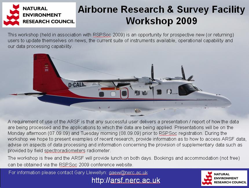
Download all attachments as: .zip