| Version 24 (modified by gaew, 17 years ago) (diff) |
|---|
Latest status for operational data collection
| Project collection status | Processing status |
Please contact Gary Llewellyn (Science / operations coordinator) if you have any questions or concerns: gaew@… (01865 374 391)
ARSF VOCALS Sitrep 11.11.08
Monday’s sortie (VA11) comprised of flying 72 degrees West along the coast to the South of Arica (as far as 23 degrees, 30 minutes South). This was flown in coordination with the 146. Both aircraft were measured pollution along the coast. Take-off was at 08:24 hrs (local), the flight lasted 4 hours and 234 GB of Eagle and Hawk data were collected.
Due to the prevailing weather patterns and the expectation of more useful weather and pollution events in following days we will not fly on Tuesday. The day will be spent resting and handling data.
ARSF VOCALS Sitrep 09.11.08
Sunday’s flight (VA10) was to proceed at approximately 15 000ft from point alpha (20 degrees South, 72 degrees West) to 20 degrees South, 76 degrees West or when contacted by the 146 crew, if sooner. At that point both aircraft were to fly back to point alpha, the Dornier above any cloud and the 146 within. Unfortunately, a problem starting the Dornier’s starboard engine delayed its take-off. The mission scientist on the Dornier contacted the science team at Hotel El Paso and it was decided to continue the flight despite this delay. Take-off was approximately two hours late (11:00 hrs local), the flight lasted 4 hrs and 12 minutes and 300 GB of Eagle and Hawk data were collected.
ARSF VOCALS Sitrep 08.11.08
A test flight (VA09) was conducted in the afternoon of the 06.11.08. This lasted for 1 hour and 30 minutes during which time ‘just under’ 100 GB of Eagle and Hawk data were collected and the Leosphere LiDAR was demonstrated to be in full working order.
Friday (07.11.08) was a change day for the pilots; in the morning David Davies and James Johnson departed Arica, Chile. There was no flying scheduled for the Dornier. The day was used to purchase oxygen and masks, to repair the QC computer (remount drives), to check that backed up data were complete (some files were being lost in transfer when the QC computer was hot or if a drive was near its capacity), evaluation of the storage strategy for those data to be collected during the remaining sorties in the campaign and the continuing process of quality checking data. In the evening Lance Dutton arrived in Arica.
Saturday was a hard down day. The regular evening meeting with those scientists using the Dornier identified the mission objectives for the following day. Later that evening Carl Joseph returned to Arica. Carl and Lance will fly the Dornier for the remaining campaign in Arica but David Davies will return for the Dornier’s transit back to the UK.
ARSF VOCALS Sitrep 06.11.08
The sortie yesterday (05.11.10) commenced with a 10:00 hrs (local) take-off. The flight followed the coast 250 nautical miles to the South with the aim of finding and mapping aerosol concentrations. The outward leg was flown in a saw-tooth manner with a maximum altitude of 15 000ft, the return leg was at 8500 ft. The flight lasted for 3 hrs and 11 minutes and 222.6 GB of Eagle and Hawk date were collected.
Yesterday afternoon the Leosphere LiDAR was removed from the Dornier. Today a technical expert from its makers has arrived to render repairs or at least facilitate an improved functionality. Should this be successful data are intended to be collected this afternoon. One of the drives in the QC computer has failed but a solution has been devised that will allow data to be downloaded, backed-up and quality checked for the rest of the campaign.
ARSF VOCALS Sitrep 04.11.08
On Monday the Dornier took off, flew at 10:00 hrs (local) and interception with the flight track of the 146 at 11:00 hrs. The main objective of the flight (VA06) was to map and characterise the high level aerosol concentrations (between 11 000 and 13 000ft) in order to determine the pollution gradient within the selected area. The flight lasted for 3 hrs and 26 minutes and 200 GB of Eagle and Hawk date were collected.
Other than the Leosphere LiDAR, which has improvised modifications to stabilise it, instruments and aircraft are performing well.
Take-off this morning (Tuesday) was at 08:30 hrs (local). During the sortie (VA07) the Dornier climbed to 15, 000 ft and proceeded to point alpha (20 degrees South, 72 degrees West). From point alpha the Dornier continued to 20 degrees South, 76 degrees West and returned at 10 000ft (in the most relevant aerosol layer). This is the Dornier’s standard flight configuration for the VOCALS campaign (e.g. VA03). The flight lasted for 4 hrs and 12 minutes and 278.5 GB of Eagle and Hawk date were collected.
ARSF VOCALS Sitrep 02.11.08
Take-off on Sunday the 2nd was at 09:00 hrs (local). The flight (VA05/VO05/VOC05) consisted of a ‘saw-tooth profiles’ where on four occasions the Dornier ascended to 15, 000ft and then descended to 4000ft. A fifth decent was in a spiral at 500 ft / minute over homogeneous cloud; the allowed the Berlin instrument to gain a 360 degree view angle over a range of altitudes. The objective was to monitor aerosols and the flight took 3 hours and twenty minutes during which 270 GB of Eagle and Hawk data were collected. An improvised temporary fix of the Leosphere LiDAR allowed some data to be collected but this instrument still required attention from its manufacturer. The aircraft and other instruments (GRIM, PSASP, AIMMS, Berlin polarimeter, AW spectrometer) continue to perform well.
We are aware and regularly informed of the worsening situation in Peru and this is information is included in operations planning. The availability of on board oxygen continues to be an issue and may require extra supplies later in the week. However, a very well received BBQ and social get-together was hosted at the El Paso Hotel. This provided a good opportunity to informally discuss the progress of the campaign, research interests and our future flights.
ARSF VOCALS Sitrep 01.11.08
Our third science flight (VA03) was flown on the Thursday the 30th (October). It comprised of a science flight to the Ron Brown US survey vessel and then four transects in the direction of the Ron Brown’s radar. The total flight time was 4 hour and 20 minute. This was the first of our flights with the under-wing pylons fitted. Unfortunately, the AIMMS 20 probe (fitted in one of the right pods) failed to store data; this problem was resolved soon after landing. The Leosphere LiDAR is still malfunctioning but it is hoped that discussions with the manufacturer will render it serviceable soon. The new system disks for the Specim Eagle and Hawk performed very well and 251 GB were collected.
As data are collected at 15, 000 ft oxygen usage has been high. Oxygen was therefore replenished in Iququie.
VA04 was flown yesterday (Friday). As with VA03, take off was at 08:00 hrs (local time). The Dornier was taken to 15, 000 ft and proceeded to point alpha (20 degrees South, 72 degrees West). Point alpha is the standard science start point though data are also collected during assent and decent. From point alpha the Dornier continued to 20 degrees South, 76 degrees West and returned. The flight time was four hours during which 270 GB of Specim data were collected and included minor saturation in a small section of the Eagle data (~ 530nm), thus providing important information regarding instrument settings in this environment.
ARSF VOCALS Sitrep 28.10.08
A second ARSF flight was conducted today. The Eagle and Hawk performed well but the Eagle continued to demonstrate disk instability at high altitude. We hope that this will soon be resolved once the hermetically sealed system disks (presently held by customs) are fitted. The flight was a test flight for the ‘Berlin polarometer’ and the Leosphere due to concerns regarding the laser. Contacts are being made to extract local GPS data collected as part of the IGP/DGF network and run by the Centre for Seismology at the University of Tarapaca. This will allow use to better process those data collected on the 26th and today and may mitigate the immediate deficiency in our capability to collect GPS data (this will be resolved on delivery of the GPS receiver tripod). The aircraft itself continues to operate without fault or problems.
22nd September
The new Leica ALS50 (II) was commissioned between the 15th and the 19th of September. Meanwhile, during the 2008 RSPSoc conference (in Falmouth) considerable positive interest was directed towards the ARSF with ARSF collected data being used in several of the presentations. The Dornier is now undergoing maintenance and a change in the instrument suite prior to its deployment in Arica, Chile in support of the VOCALS atmospheric campaign.
19th August
During a period of good conditions over London on the evening, night and morning of the 14th-15th of August data were collected in support of GB08-19. Following this acquisition weather condition deteriorated and have continued to be unsuitable for data collection since. The PCAP instrument was test fitted on the Monday (18.08.08), in prepration for the VOCALS deployment in October, and research teams for projects based in North Wales, the Midlands and the Peak District were primed for a possible improvement of conditions at the end of the week.
11th August
Most forecasts do not indicate suitable conditions for the collection of good quality data this week. However, conditions look encouraging for London on Thursday and Friday and some forecasts indicate that the South of England may be clear on Thursday morning; the West of Scotland may be clear on Friday morning; the East of Scotland clear on Sunday morning and the Peak district and North/West Wales on Monday morning. If conditions continue to be forecast as good for London on Thursday, this will be our primary site from which we will direct our data collection efforts.
Although most of Iceland is clear of cloud the IPY07-09 study site has a tongue of cloud across it. This is forecast to cover the whole island by the weekend.
22nd July
Although some regions in the UK have had good weather during the last few days most of the key science project sites have been in areas where cloud has been present. Nevertheless, the ARSF are not available for the collection of data, the hyperspectral instruments are undergoing calibration / validation with FSF and the Optech LiDAR continues to be in use by its owners at ULM. Remote sensing is due to resume on the 11th of August. During August (after 11.08.08) we will endeavour to collect data from the Midlands, North/West Wales, Cumbria and Scotland. However, during this period our priority sites will be London (in support of GB08-19) and Iceland (in support of IPY07-09). An emailed indication of our flying timetable based on forecasted weather conditions should be distributed in the first week of August. If any research team that anticipates having data collected from their site/sites needs further information then they should contact Gary Llewellyn on 079 1969 7851.
15th July
Yesterday (14.07.08) a failure in the AISA Eagle control system cause us to abort an attempt to collect data from the North bank of the Thames; this problem has been corrected. Unfortunately, despite the present good weather in the South and East of the UK conditions continue to be unfavourable in the Midlands, Cumbria and Scotland. We hope to be able to collect data from Wytham Woods and the Thames this week, however, the passive remote sensing instruments are due to be removed from the aircraft on Friday (18.07.08) in preparation for calibration/validation with FSF in following week. The research teams for one of the Peak District (GB08-02) projects and the project based in North Wales (GB08-13) have deferred the next collection for these projects to August when data collection (with the LiDAR fitted on DCALM) should resume on the 12th of August (12.08.08).
9th July
Weather conditions continue to be unpromising. We do not anticipate collecting any data this week and the forecasts are not encouraging for the start of the next week. The AISA Eagle and Hawk instruments are due to be removed from the aircraft on the 19th of July for transit to Edinburgh for calibration/validation with the FSF and ARSF-DAN.
3rd July 2008
Data were collected from three sites on the 1st of July and it is our intention to collect data from another two sites on Friday (04.07.08), one of which we hope will be synchronised with the collection of LiDAR data by ULM. Our intention is to support projects in Cumbria and Scotland in the coming week. However, support of science in North Wales continues to be problematic. The collection of remotely sensed data should continue until the long overdue calibration/spectral validation of the AISA Eagle and Hawk (21/06/08) and should resume with the LiDAR unified with the other instruments on the Dornier early in August (11/08/08).
25th June 2008
Minor repairs were completed and data were collected from one site in Southern England but cloudy conditions prevailed across our main project areas (Scotland, Cambria, the Midlands and Wales). Contact with research teams, RSPB shops and regular evaluations (based on webcams and a range of weather observation and forecasting websites) did not indicate that conditions would improve before dusk. We hope to be able to support these projects in the next seven days.
19th June 2008
During yesterdays flight the belly-door that protects the remote sensing instruments during take-off, landing and transit seized to the point of not opening. This problem only manifested itself when the aircraft was airborne; therefore it was not identified in the ground checks conducted after the latest sequence of maintenance work. An engineer has arrived from Germany to repair the fault and we hope to be collecting data as soon as possible.
The Optech Airborne Laser Terrain Mapper 3033 will not be available for fitting in the Dornier until the middle of August 2008 and will be returned to its owners after five weeks. Within this time period data were planned for collection from the French Alps and Iceland. Some of the most highly graded projects that require the repeat acquisition of LiDAR data will have those data collected coincidentally in another aircraft by a subcontractor. Some projects that relied on LiDAR data (especially those with multiple acquisitions or those that cannot be supported between 15/08/08 and 11/09/08) will not be supported in 2008. Those projects that had LiDAR data as a primary component and were awarded a low alpha four grade in the 2007/2008 application/review round will not be supported in 2008 and will not be rolled over for collection in 2009. Those projects awarded a mid alpha four grade or higher for which we have been unable to make special data collection arrangements for will be rolled over to 2009. Where a project retains its scientific justification without LiDAR data the ARSF will endeavour to support it as best we can.
11th June 2008
The Dornier's repaired engine has been replaced and the final items of outstanding maintenance should be completed for its return to the UK on the 13th of June. Following this the ARSF have two days of unavoidable procedural commitments. The collection of remotely sensed data should resume at the end of next week (~19th) and continue for the rest of June and most of July.
22nd May 2008
The ARSF's last flight in support of the EUCAARI IMPACT campaign (NL08-01) concluded on the 21st of May. Cloud cover contined to prevent UK remote sensing on the 22nd and the Dornier is due to transit to Germany on the 23rd for the loaned left hand engine to be replaced by our repaired engine. UK remote sensing should resume in the second week of June.
9th May 2008
Clear weather in the Netherlands prevented scientific the support of the EUCAARI IMPACT campaign (NL08-01). This resulted in greater availability of the aircraft in the support of UK remote sensing projects. However, the three days of clear, bright conditions (6th, 7th & 8th) have allowed many of the UK projects with multiple acquisitions to be started. Unfortunately this period was too late for some projects in the South of England that needed 'leaf-off' conditions. Data were collected on all of the clear three days and pre-dawn on the 9th.
22nd April 2008
Following the fitting of a loaned engine the NERC ARSF aircraft has resumed support for UK remote sensing. During the first two weeks in May data collection time will be shared between the support of UK remote sensing and participation in an International experiment in support of science (EUCAARI - NL08/01). The Cambridge LiDAR should be available in the NERC aircraft at the end of May, just after the aircraft is refitted with the repaired engine.
20th March 2008
The NERC ARSF aircraft is presently in Germany. It is undergoing maintenance on its engines and will undergo CAA certification. Following its return to the UK it will be engaged in the support of Atmospheric science. Support for UK remote sensing will resume in mid. April.
Attachments (1)
-
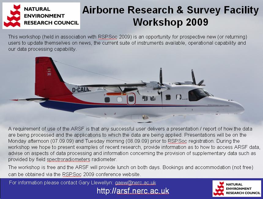
Flier.jpg
(117.2 KB) -
added by gaew 17 years ago.
Workshop flier 2009 07.04.09
Download all attachments as: .zip