Custom Query (432 matches)
Results (112 - 114 of 432)
| Ticket | Resolution | Summary | Owner | Reporter |
|---|---|---|---|---|
| #109 | fixed | Output of ground coordinates in azgcorr | mggr | mggr |
| Description |
It would be useful if azgcorr could output some extra information on the mapping of points. Peter Land was interested in level 1 ground coordinates per pixel. Chris Hecker (#108) has requested per-pixel geocoordinates or per pixel view vector info for feeding into ATCOR, also presumably at level 1. He said ATCOR needed, as an input parameters for the atmospheric correction model, the viewing geometry and distance between plane and each pixel. This can be supplied either as:
Peter contacted Bill about it, who replied (1/May/2007) with: The option to 3D output pixel coordinates, solar and sensor view vector details and time are on the cards for Andrew's group to use with Modtran, so in the not too distant future will be available. |
|||
| #110 | fixed | Azspec processed Hawk data has spectral spikes | mggr | benj |
| Description |
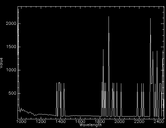
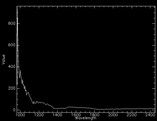
Azspec-processed level 1b hawk data does not appear to be correct - it contains large anomalous spikes in some bands, seemingly correlated to very low data values. Eg from Nigg Bay line 3: Compared to Caligeo spectrum from same pixel: Could be underflowing, but would expect a much higher value for the spikes (~65k) in this case. Might still be underflowing and then changed by maths in azspec though. Note extended from ticket #106, but separate to Hawk noise issue |
|||
| #114 | fixed | Az* lever arm better with offsets | mggr | benj |
| Description |
The az* lever arm format is currently gam/del/dst (two angles and a distance) for legacy reasons. These reasons are now irrelevant, so for clarity and ease of calculation it would be better if az* used x/y/z offsets (three distances) instead. |
|||

