Opened 18 years ago
Closed 16 years ago
#119 closed bug (fixed)
Difference between Azspec and Caligeo processed Hawk data
| Reported by: | benj | Owned by: | benj |
|---|---|---|---|
| Priority: | alpha 5 | Milestone: | |
| Component: | az* programs | Keywords: | |
| Cc: | mggr | Other processors: |
Description (last modified by benj)
Split off from ticket #113.
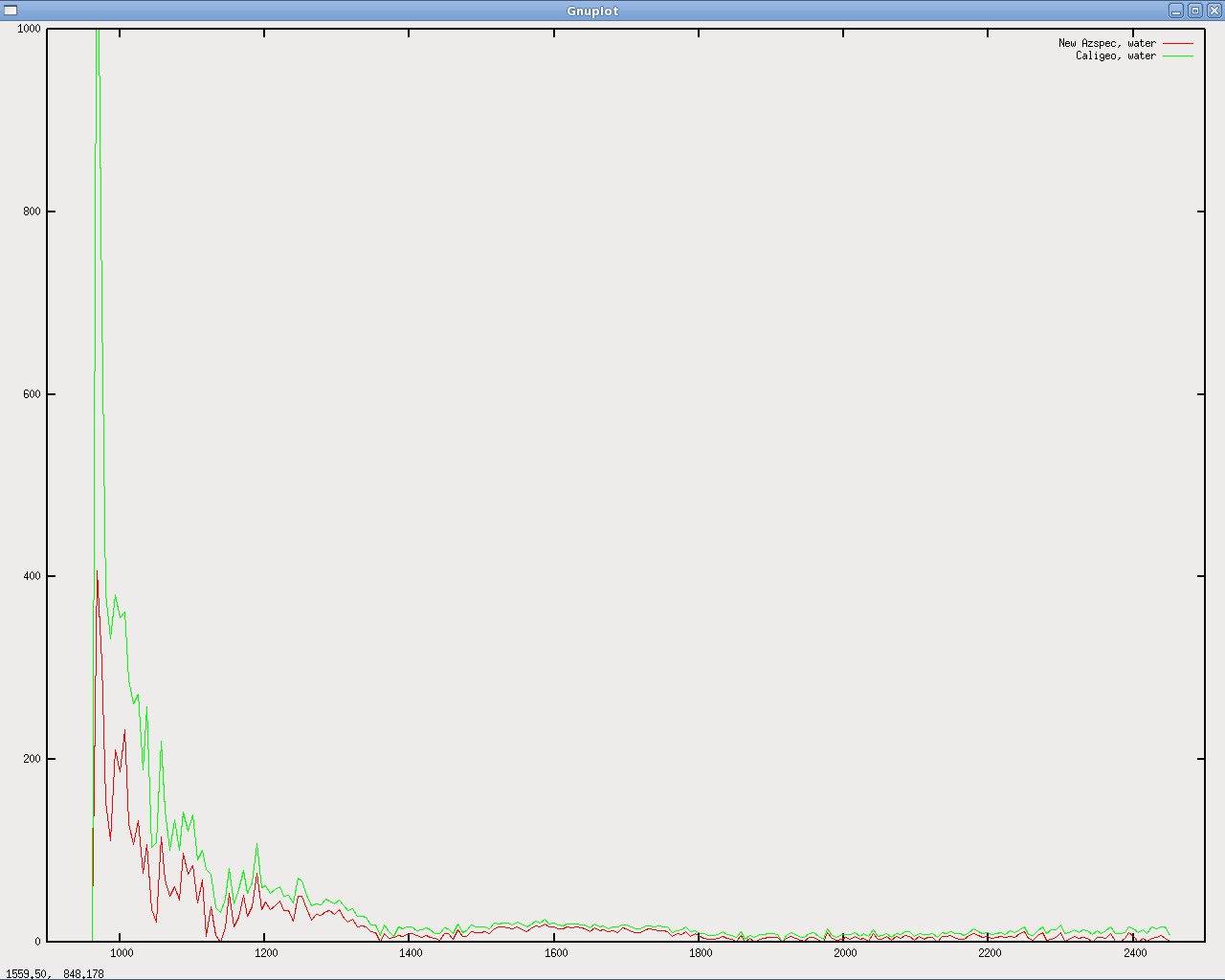
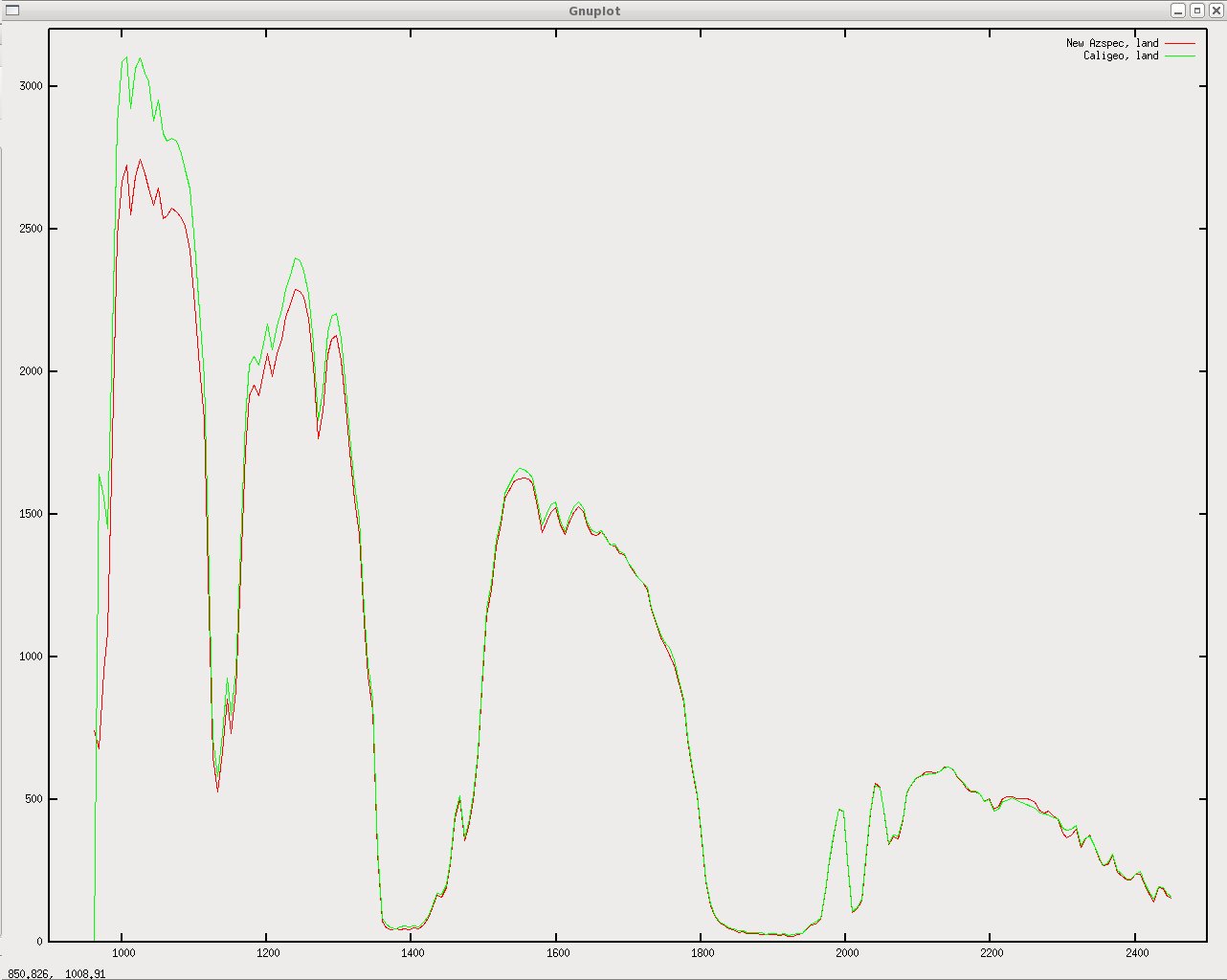
Hawk data processed with Azspec and Caligeo shows a gap between the two, particularly at the short-wave end of the spectrum. Over land the two are very close at the longer-wave end, over water Caligeo is consistently higher than Azspec (though the gap is larger at the short-wave end). Azspec data looks more plausible but Hawk needs calibrating to check which (if either) is correct.
Attachments (3)
Change History (6)
Changed 18 years ago by benj
comment:1 Changed 18 years ago by benj
- Description modified (diff)
comment:2 Changed 18 years ago by mggr
Note FODIS data also show this difference (#133)
Changed 16 years ago by benj
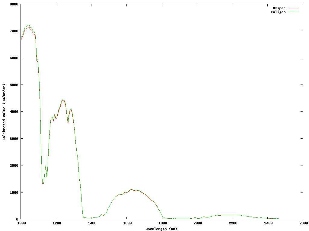
Difference between azspec and caligeo from GB08/12 152a/2009 line 5 (fixed)
comment:3 Changed 16 years ago by benj
- Resolution set to fixed
- Status changed from new to closed
Problem seems to have gone away. May have been fixed by a number of different changes to azspec, azgcorr or Caligeo, so we don't know which one was wrong.
Graphs now match pretty well (see below). Small remaining difference is likely to be due to the fact that the two programs don't do the geolocation exactly the same, the difference is even smaller if the same graph is produced using the level 1 files.


Azspec and Caligeo processed data over water