| Version 70 (modified by wja, 2 years ago) (diff) |
|---|
Data Processing at NERC-ARF-DAN
These pages provide an overview of data processing applied at NERC-ARF-DAN after data are received from operations and act as internal documentation. For a single page overview of the processing see the following poster from RSPSoc 2016 (PDF).
Project processing procedure
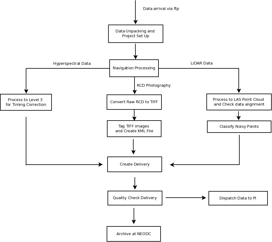
This page contains links to detailed step-by-step instructions on how to deal with data from arrival to dispatch to the user. Please keep updated. A simplified overview of the procedures can be seen in the flow chart. Clicking on the relevant section will give a more detailed, technical description.

Instrument Calibration
These procedures are carried out once per season or whenever the instruments are removed and refitted to the plane.
- Hyperspectral calibration
- Bad pixel file generation (part of hyperspectral calibration)
- Leica LiDAR
- Leica RCD105 Digital Camera
Instrument Boresighting
Calibration Sites
- Alconbury site details - 2017 onwards
- Little Rissington site details - September 2008 to October 2015
- Monks Wood site details - up to September 2008
- Gloucester
Other procedures
- Summary of 2023 Installations
- Reprocessing Eagle and Hawk data
- Reprocessing CASI data
- Processing Owl data
- Specim's Owl Tool
- Additional photogrammetry processing using PhotoScan
- Information on proj_tidy.sh
- What needs to be done prior to starting a new season
- Procedures to follow for hyperspectral reprocessing
- Guide to splitting VNIR and SWIR from Fenix
- Guide to splitting Lidar and hyperspectral files spatially
- Checking the spectra with Py6S
- Atmospheric correction using ATCOR
- Information on ground surveys for atmospheric correction
- Information on processing the InfraTec thermal data
Guides to using non-standard software and obsolete software processing methodology
- How to update azgcorr and who to notify
- Processing with CaliGeo
- Handling bad ATM scanlines with az software
- Creation of DEMs from Optech LIDAR point clouds (pre-2009 data)
- Tips on using Microstation and TerraScan
- Match 2 images by boresight corrections
- How to generate overflow and low signal masks for specim sensors
- How to use the visualisation machine and software
- (2010 and earlier) r-syncing from the workspace to the repository
Information on data in system
Attachments (1)
-
simple_overview.jpeg
(47.1 KB) -
added by mark1 14 years ago.
Simple overview of the procedural chain
Download all attachments as: .zip